place

Spen Lane

Streets in YorkUse British English from September 2022
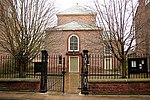
Spen Lane, York. geograph.org.uk 529309

Spen Lane is a street in the city centre of York, in England.

Excerpt from the Wikipedia article Spen Lane (License: CC BY-SA 3.0, Authors, Images).

Spen Lane
St Andrew Place, York Layerthorpe

Geographical coordinates (GPS) Address Nearby Places
placeShow on map

Wikipedia: Spen LaneContinue reading on Wikipedia

Geographical coordinates (GPS)

Latitude Longitude
N 53.9605 ° E -1.0778 °
placeShow on map

Address

St Andrew Place

St Andrew Place
YO1 8NQ York, Layerthorpe
England, United Kingdom
mapOpen on Google Maps

Spen Lane, York. geograph.org.uk 529309
Share experience

Nearby Places

York
York

York is a cathedral city in North Yorkshire, England, with Roman origins, sited at the confluence of the rivers Ouse and Foss. It is the historic county town of Yorkshire. The city has many historic buildings and other structures, such as a minster, castle, and city walls. It is the largest settlement and the administrative centre of the wider City of York district. The city was founded under the name of Eboracum in 71 AD. It then became the capital of the Roman province of Britannia Inferior, and later of the kingdoms of Deira, Northumbria, and Scandinavian York. In the Middle Ages, it became the northern England ecclesiastical province's centre, and grew as a wool-trading centre. In the 19th century, it became a major railway network hub and confectionery manufacturing centre. During the Second World War, part of the Baedeker Blitz bombed the city; it was less affected by the war than other northern cities, with several historic buildings being gutted and restored up to the 1960s.The city is one of 15 in England to have a lord mayor, and one of three to have The Right Honourable title affixed, the others being London's and Bristol's. Historic governance of the city was as a county corporate, not included in the county's riding system. The city has since been covered by a municipal borough, county borough, and since 1996 a non-metropolitan district (the City of York), which also includes surrounding villages and rural areas, and the town of Haxby. The current district's local council is responsible for providing all local services and facilities throughout this area. The city had a population of 153,717 in the 2011 census; the wider district had a population of 198,100. According to 2021 census data, the wider district has a population of 202,800, a 2.4% increase compared to the 2011 census.

Oliver Sheldon House

The Oliver Sheldon House is a Grade II* listed house on Aldwark, in the city centre of York, in England. The earliest surviving part of the house is some 15th-century internal framing. In the late 16th century, a block was added to the rear, the design of which is tentatively attributed by the Royal Commission on the Historical Monuments of England (RCHME) to William Garbutt. In 1703, it was purchased by Charles Redman, who soon became Lord Mayor of York. He rebuilt the exterior, in brick, in about 1720, the work being completed under his son William. He sold the house in 1748, following which it was divided, and the south-east doorway was added. By the mid-19th century, part of the building operated as the Ebor Tavern. In 1961, the whole building was donated to the York Civic Trust, which commissioned Francis Johnson to restore it as flats, the work being complete in 1969. The trust named the property after Oliver Sheldon, who had been a leading figure in the organisation.The building is of two storeys and an attic, with the front having eight windows and two doors. The front is of orange brick, with a stone plinth and a timber cornice. One drainhead is dated 1732. Internally, much 18th-century work survives, including the flooring in the entrance and staircase halls, the oak main staircase, the ceiling above the staircase, and the panelling of two ground floor rooms. The half-landing, in the middle of the staircase, has a wooden floor which the RCHME describe as "exceptional". One rear ground floor room has an early-17th century ceiling, and a fireplace surround which was moved from 27 Trinity Lane in 1969.

Lady Hewley's Almshouses

Lady Hewley's Almshouses are a historic building in the city centre of York, in England. Sarah Hewley founded almshouses on Tanner Row in 1700, run by the Lady Hewley Trust. These were demolished to allow the construction of York's original railway station, and a replacement building on St Saviourgate was completed in 1841. The construction cost £1,711. The buildings are still in use as almshouses, and are still run by the same trust.The building was designed by James Pigott Pritchett, in a Tudor Revival style. The building formerly had nine apartments and a chapel, but in 1975, the chapel was converted into an additional apartment. The front of the almshouses is of stone, and the rear of brick. The building is two storeys high, with a cellar. Its main part has nine windows on each floor, and there are wings at either end. The front has three entrance doors, while there are two doors in the right-hand facade, which overlooks Stonebow. Inside, movable panels partition the entrance halls. The original kitchen ranges survive, as do the first floor fireplaces, although these are now blocked. The warden's house has two storeys and a three bay front, and is built of stone. In the 20th century, a single-storey extension was added to the right of the building. There is a tablet in the end wall, moved from the original building, which records its foundation. The buildings were Grade II listed in 1954; the gate piers and railings also form part of the listing.