Smith River (Umpqua River tributary)
.jpg)
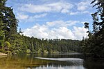
The Smith River is a 90-mile (140 km) tributary of the Umpqua River in the U.S. state of Oregon. It drains 352 square miles (910 km2) of the Central Oregon Coast Range between the watershed of the Umpqua to the south and the Siuslaw River to the north.Rising in northern Douglas County about 10 miles (16 km) north of Drain, the river flows generally west in a winding course through the mountains, passing through the Siuslaw National Forest for about 10 miles (16 km) in its lower course. It joins the Umpqua from the north across from Reedsport, about 6 miles (10 km) from the mouth of the Umpqua on the Pacific Ocean.The river is named for Jedediah Smith, who in 1828 led a party of explorers from Utah overland to northern California and southern Oregon. From California, they traveled north to the Umpqua River, camping along its banks near the mouth of the Smith River on July 13. An attack by Native Americans on July 14 killed 15 of Smith's party. One man escaped by heading north to Tillamook and then Fort Vancouver. Smith and two others who were not in camp at the time of the attack fled east toward the Willamette Valley and survived. The Smith River in California is also named for Smith.
Excerpt from the Wikipedia article Smith River (Umpqua River tributary) (License: CC BY-SA 3.0, Authors, Images).Smith River (Umpqua River tributary)
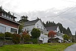
Lower Smith River Road,
Geographical coordinates (GPS) Address Nearby Places Show on map
 Continue reading on Wikipedia
 Geographical coordinates (GPS)
| Latitude | Longitude |
|---|---|
| N 43.736944444444 ° | E -124.07861111111 ° |
Address
Lower Smith River Road
Lower Smith River Road
97441
Oregon, United States
Open on Google Maps