place

Mount Keira

Illawarra escarpmentMountains of New South WalesSuburbs of WollongongTourist attractions in New South WalesUse Australian English from September 2017
Wollongong
Wollongong city
Wollongong city

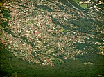
Mount Keira () is a suburb and mountain in the Illawarra region of New South Wales, Australia. Mount Keira is a site of significant cultural heritage for the Wodi Wodi people. The name Mount Keira derives from the Wodi Wodi name for the mountain, Geera or Djera. The first maps of the area called it Keera, later adding the 'i'. Mount Keira forms a part of the Illawarra escarpment, all of which is sacred land to the Wodi Wodi people of the wider Dharawal language group. The suburb of Mount Keira, a semi-rural township of Wollongong, located on the mountain's summit and southern flank. The summit of Mount Keira has an elevation of 464 metres (1,522 ft) above sea level that is located 4 kilometres (2.5 mi) northwest of the city of Wollongong. Its distinctive shape and proximity to Wollongong make it a major local landmark. It is noted for the views of the city from the popular summit lookout and its history of coal mining. It was formed as part of the Illawarra escarpment fold between 80 and 60 million years ago and the erosion by creeks that ensued.

Excerpt from the Wikipedia article Mount Keira (License: CC BY-SA 3.0, Authors, Images).

Mount Keira
Camp Road, Wollongong City Council Mount Keira

Geographical coordinates (GPS) Address Nearby Places
placeShow on map

Wikipedia: Mount KeiraContinue reading on Wikipedia

Geographical coordinates (GPS)

Latitude Longitude
N -34.4 ° E 150.85 °
placeShow on map

Address

Camp Road

Camp Road
2500 Wollongong City Council, Mount Keira
New South Wales, Australia
mapOpen on Google Maps

Wollongong city
Wollongong city
Share experience

Nearby Places

West Wollongong, New South Wales

West Wollongong is the innermost western suburb of the coastal city of Wollongong, New South Wales, Australia. It is mainly a residential area, serviced by a small commercial strip with a music store, chicken shop, electric goods store and carpet store along the Princes Highway with several petrol stations, two restaurants, a liquor store, a chemist and a flower shop. Schools in the area include Wollongong West Public School, St Therese Primary School, The Illawarra grammar school, and Edmund Rice College (an all-boys secondary college). St Marks Anglican Church serves the area of West Wollongong in a variety of ways. The church runs an EFL class (English for Life), Food and friends, Playgroup, Youthgroup, Mother's Union, University Student Housing, Soccer teams' as well as their three services on a Sunday (8am, 10am and 5pm) that cater for a variety of ages including children. The church is open during the week with Saint's Espresso and a playground for people to connect with and to support the community. (see James Ulrich the local church historian for more details) It is the location of the Mount Keira Road turnoff from the Princes Highway, incidentally the westernmost end of Crown Street. Illawarra Institute of TAFE also has a campus at West Wollongong with a focus on Information Technology, Hairdressing, Beauty Therapy, Arts and Media, Fashion Technologies, Meat and Allied Trades. It includes Karoona Gallery.

Balgownie, New South Wales

Balgownie () is a small suburb of Wollongong, New South Wales, Australia. Balgownie lies to the north-west of the Wollongong CBD. It stretches from the lower slopes of Mount Keira along the Illawarra escarpment to the base of the Broker's Nose promontory. To the east, Balgownie is bordered by the light industrial and commercial suburb of Fairy Meadow. The main street, Balgownie Road, connects the suburb to the nearby Princes Highway. Balgownie is mostly residential with a small commercial centre known as the Balgownie Village. Balgownie has a similar history to many towns on the NSW south coast. When first settled in the 19th century, Balgownie was the centre of local logging, coal mining and farming industries. With the economic and population growth of the 20th century Balgownie was overtaken by the expanding urban sprawl and transformed from a small country hamlet to a residential suburb. Balgownie is home to citizens right across the socioeconomic spectrum, from public housing estates in the east to multimillion-dollar mansions on the escarpment. Sites of interest include the Balgownie Public School's museum, The Bally Pub, Balgownie Village Patisserie (formerly Kristian's Bakery), the Urban Grind Cafe and the war memorial. This war memorial will have extensive developments during the next few years. There are also several fine eateries in the suburb including Il Porcellino and Il Nido which serve Australian and Italian cuisine. Over the last five years, the Australian property market has exploded and as a result many of the open spaces and paddocks that once greened the suburb have been turned into town house or "villa" developments. The area features the oldest active soccer club in Australia, Balgownie Rangers, founded in 1883.