Mount Pleasant, New South Wales
Illawarra region geography stubsSuburbs of WollongongUse Australian English from August 2019
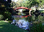
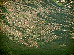
Mount Pleasant is a hilly suburb in the city of Wollongong, New South Wales, Australia. It is situated on the northern flank of Mount Keira extending across to the Illawarra escarpment and is exclusively residential. It is home to the Rhododendron Park, found on Parrish Avenue. Mount Pleasant has a small local primary school Pleasant Heights Public School which has approximately 180 enrolled students. The suburb is locally notable for its commonly known Brokers Road which is amongst the steepest roads in New South Wales.
Excerpt from the Wikipedia article Mount Pleasant, New South Wales (License: CC BY-SA 3.0, Authors).Mount Pleasant, New South Wales
New Mount Pleasant Road, Wollongong City Council Mount Pleasant
Geographical coordinates (GPS) Address Nearby Places Show on map
Geographical coordinates (GPS)
| Latitude | Longitude |
|---|---|
| N -34.39569 ° | E 150.867 ° |
Address
New Mount Pleasant Road
New Mount Pleasant Road
2519 Wollongong City Council, Mount Pleasant
New South Wales, Australia
Open on Google Maps


