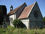
Studley, Warwickshire
Villages in Warwickshire

Studley is a large village and civil parish in the Stratford-on-Avon district of Warwickshire, England. Situated on the western edge of Warwickshire near the border with Worcestershire, it is 3.5 miles (6 km) southeast of Redditch and 13 miles (21 km) northwest of Stratford-upon-Avon. The Roman road of Ryknild Street, now the A435, passes through the village on its eastern edge, parallel to the River Arrow. The name derives from the Old English leah, being a meadow or pasture, where horses, stod, are kept.The United Kingdom Census 2001 reported Studley's population as being 6,624, decreasing to 5,879 at the 2011 Census.
Excerpt from the Wikipedia article Studley, Warwickshire (License: CC BY-SA 3.0, Authors, Images).Studley, Warwickshire
Square des Corolles, Nanterre
Geographical coordinates (GPS) Address Nearby Places Show on map
Geographical coordinates (GPS)
| Latitude | Longitude |
|---|---|
| N 52.26961 ° | E -1.89151 ° |
Address
Cœur Défense
Square des Corolles
92400 Nanterre, Quartier Gambetta
Île-de-France, France
Open on Google Maps


