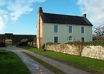
Brailsford
Civil parishes in DerbyshireDerbyshire DalesTowns and villages of the Peak DistrictVillages in Derbyshire

Brailsford (52°58′16″N 1°37′26″W) is a small red-brick village and civil parish in Derbyshire on the A52 midway between Derby and Ashbourne. The parish also includes Brailsford Green. The civil parish population at the 2011 Census was 1,118. The village has a pub, a golf club, a post office and a school. There are many fine houses in the district including two 20th-century country houses: Brailsford Hall built in 1905 in Jacobean style, and Culland Hall.
Excerpt from the Wikipedia article Brailsford (License: CC BY-SA 3.0, Authors, Images).Brailsford
Hausstein, Lalling (VGem)
Geographical coordinates (GPS) Address Phone number Website Nearby Places Show on map
Geographical coordinates (GPS)
| Latitude | Longitude |
|---|---|
| N 52.971 ° | E -1.623 ° |
Address
ASKLEPIOS Klinik Schaufling
Hausstein 2
94571 Lalling (VGem)
Bayern, Deutschland
Open on Google Maps


