place

Queen's High School, Dunedin

1955 establishments in New ZealandEducational institutions established in 1955Girls' schools in New ZealandNew Zealand school stubsSecondary schools in Dunedin
Queen's High School, Dunedin

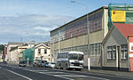
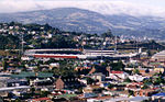
Queen's High School is a state single-sex girls' secondary school in Dunedin. It is located at the southern end of the city close to the boundary between the suburbs of St Clair and Forbury, next to the parallel single-sex boys' school, King's, with which it shares some facilities. Pat Harrison (later Dame Pat) was principal of the school from 1975 to 1994.

Excerpt from the Wikipedia article Queen's High School, Dunedin (License: CC BY-SA 3.0, Authors, Images).

Queen's High School, Dunedin
Surrey Street, Dunedin South Dunedin

Geographical coordinates (GPS) Address Phone number Website External links Nearby Places
placeShow on map

Wikipedia: Queen's High School, DunedinContinue reading on Wikipedia

Geographical coordinates (GPS)

Latitude Longitude
N -45.903551 ° E 170.492071 °
placeShow on map

Address

Queens High School

Surrey Street 195
9012 Dunedin, South Dunedin
Otago, New Zealand
mapOpen on Google Maps

Phone number

call+6434557212

Website
queens.school.nz

linkVisit website

linkWikiData (Q7270012)
linkOpenStreetMap (116802693)

Queen's High School, Dunedin
Share experience

Nearby Places

Forbury, New Zealand

Forbury is a small residential suburb of the New Zealand city of Dunedin. It is 3 kilometres (1.9 mi) south-southwest of the city centre and lies immediately to the north of St Clair, between it and Caversham. The suburb is low lying, having originally been marshy land reclaimed in the later 19th century. As such, it is often prone to flooding. It lies at the northwest corner of a plain that stretches across South Dunedin and St Kilda known locally as "The Flat". The land rises to the northwest of the suburb to form Caversham Valley, and immediately to the west the land rises abruptly in a cliff face that is located one kilometre inland from St Clair Beach. The suburb stretches to the east of this cliff across the plain towards South Dunedin. Apart from Caversham and St Clair, Forbury is bounded by St Kilda in the south, Kew in the west, and South Dunedin in the east. The name Forbury is somewhat confusing, as it is used for several local features, not all of them within the suburb. Notable among these is the former Forbury Park Raceway, one of the city's main horse-racing venues, which actually lies in St Kilda. Forbury Corner, an important road junction, lies in Caversham, though not far from the northern boundary of Forbury. Prominent features of Forbury include Tonga Park, a sports ground used by Caversham Football Club, and the twin single-sex secondary schools, King's and Queen's. Forbury Road is the suburb's main arterial route, aligned roughly north-south and linking Caversham at Forbury Corner with St Clair at the Esplanade. The suburb's other main roads include Bay View Road, Macandrew Road, Surrey Street, and Easther Crescent. Dunedin's main LDS church sits close to the cliff face at the suburb's western edge, and one of the city's main retirement villages, the Frances Hodgkins Retirement Village is built against the cliff face immediately to the north.

Forbury Park Raceway

Forbury Park Raceway was a horseracing venue in the New Zealand city of Dunedin until its closure in 2021. It was located close to the Pacific Ocean coast in the suburb of Saint Kilda. The raceway was initially developed in 1870 on an area of reclaimed swamp, with a one-mile track leased to the Dunedin Jockey Club. The site was used for both galloping and saddle trotting events until 1898, at which time the Dunedin Jockey Club moved to a new venue at Wingatui, near Mosgiel. Light harness racing began at Forbury in 1909, at about which time the track was reduced to approximately 1100 yards (1000 metres). The installation of floodlights in 1960 saw the advent of night trotting. The venue is currently used for both harness racing and greyhound racing, as well as for other large-scale outdoor events. It is one of the country's main trotting venues. The Forbury Park Trotting Club marked 100 years of harness racing at Forbury Park with a race meeting on Thursday 26 November 2009, the identical date of the first meeting on the track in 1909. The club itself had been racing for 110 years at that stage as its first meeting had been at Tahuna Park in May 1892. It had held a centennial meeting in October 1992.Forbury Park was the first club in the South Island to hold a night trotting fixture with the inaugural such meeting on Thursday, 26 January 1961.An especially historic year for the club was 1965, when, with a new members' stand built for the occasion, it hosted the famed Inter Dominion series. This was the only Inter Dominion ever held in New Zealand outside of either Auckland or Christchurch. Robin Dundee and Jay Ar dead-heated for first place in the Inter Dominion Pacing Championship while Poupette won the Inter Dominion Trotting Championship. Forbury Park also hosted Long Track Motorcycle Speedway, with the New Zealand Long Track Championship held there seven times from 1982 to 1988. The first four championships were won by legendary New Zealand rider Ivan Mauger.

Caversham, New Zealand

Caversham is one of the older suburbs of the city of Dunedin, in New Zealand's South Island. It is sited at the western edge of the city's central plain at the mouth of the steep Caversham Valley, which rises to the saddle of Lookout Point. Major road and rail routes south lie nearby; the South Island Main Trunk railway runs through the suburb, and a bypass skirts its main retail area, connecting Dunedin's one-way street system with the Dunedin Southern Motorway. The suburb is linked by several bus routes to its neighbouring suburbs and central Dunedin. The suburb was founded by wealthy pioneer William Henry Valpy, and its name reflects his family connections with the town of Reading, in the English county of Berkshire. Caversham grew rapidly during the Central Otago Gold Rush of the 1860s because of its location on routes south to the Otago hinterland. By the end of the 19th century, Caversham was heavily industrialised, and its population included many skilled or semi-skilled tradespeople. This, combined with the community's strong Protestant roots, led to the area's generally left-leaning political stance. Caversham's early history has been the subject of the Caversham Project, a major historical and archaeological study by the University of Otago. Caversham was a separate borough until 1904, when it was amalgamated with Dunedin city. At a national level, it is part of the Taieri electorate. Caversham is now predominantly residential, with some industrial premises in the east (notably the Hillside Railway Workshops) and a retail district centred on South Road and Hillside Road. Residents are generally of low socio-economic status. Caversham's notable buildings include the heritage listed Lisburn House and several prominent church buildings. Another landmark is the suburb's war memorial, which is the main gate of Caversham School, the suburb's primary school. Caversham also contains a special-needs school. The nearest secondary schools operate in St Clair, 1 kilometre (0.62 mi) to the south. Caversham has strong sporting connections, and is the location of Carisbrook, until recently one of Dunedin's main sports venues. The suburb is home to the Southern Rugby Football Club, and gives its name to Caversham Football Club. Several notable sportspeople have associations with Caversham, among them Test cricketer Clarrie Grimmett and father and son rugby union administrators "Old Vic" and "Young Vic" Cavanagh. Other notable people with Caversham connections include politician Thomas Kay Sidey, architect Edmund Anscombe, and surveyor John Turnbull Thomson.