1692 Northwestern Europe earthquake
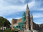
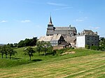
The 1692 Verviers earthquake, also known as the 1692 Ardennes earthquake, occurred in the east of Belgium on 18 September 1692 measuring around 6.2 on the Richter scale. Parish records and historical accounts strongly indicate the earthquake's epicenter was northwest of Verviers, and the event was widely felt across Western Europe in Belgium, England, Germany, the Netherlands, Luxembourg, and France. The largest amount of damage occurred in the northwestern environs of Verviers, then part of the Prince-Bishopric of Liège. Researchers at the Royal Observatory of Belgium have considered this the strongest known earthquake in Western Europe north of the Alps, which occurred as part of a sequence of quakes from the Lower Rhine Graben in September 1692.
Excerpt from the Wikipedia article 1692 Northwestern Europe earthquake (License: CC BY-SA 3.0, Authors).1692 Northwestern Europe earthquake
Avenue Henri Massin,
Geographical coordinates (GPS) Address Nearby Places Show on map
Geographical coordinates (GPS)
| Latitude | Longitude |
|---|---|
| N 50.61 ° | E 5.825 ° |
Address
Avenue Henri Massin
4800
Liège, Belgium
Open on Google Maps


