Ombersley and Doverdale
Local government in WorcestershireWorcestershire geography stubsWychavon

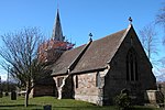
Ombersley and Doverdale is an area in Wychavon district, Worcestershire, England served by a single parish council but comprising the two separate civil parishes of Ombersley and Doverdale. The parish council website, as of April 2022, states that "combining of the Parishes of Ombersley and Doverdale in 1973 created one of the largest parishes in Worcestershire", and the Neighbourhood Development Plan refers (eg page 5) to "the parish of Ombersley and Doverdale", but other sources - Office for National Statistics, Ordnance Survey, MapIt, NHLE - indicate that the two parishes still exist as separate entitities.
Excerpt from the Wikipedia article Ombersley and Doverdale (License: CC BY-SA 3.0, Authors, Images).Ombersley and Doverdale
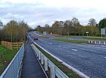
A449, Wychavon
Geographical coordinates (GPS) Address Nearby Places Show on map
Geographical coordinates (GPS)
| Latitude | Longitude |
|---|---|
| N 52.279 ° | E -2.228 ° |
Address
A449
WR9 0DQ Wychavon
England, United Kingdom
Open on Google Maps


