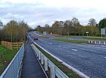
Hawford
AC with 0 elementsVillages in WorcestershireWorcestershire geography stubs

Hawford is a hamlet in Worcestershire, England. It falls within two parishes; North Claines and Ombersley and Doverdale in the outer suburbs of Worcester about 3 miles from the city centre. It is bisected by the River Salwarpe, the Droitwich - Worcester Canal and is also bounded by the River Severn.
Excerpt from the Wikipedia article Hawford (License: CC BY-SA 3.0, Authors, Images).Hawford
Chatley Lane, Worcester, England
Geographical coordinates (GPS) Address Phone number Nearby Places Show on map
Geographical coordinates (GPS)
| Latitude | Longitude |
|---|---|
| N 52.244554 ° | E -2.226491 ° |
Address
Hawford Dovecote
Chatley Lane
WR3 7SG Worcester, England
England, United Kingdom
Open on Google Maps


