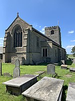
River Cocker, Lancashire

The River Cocker is a river in Lancashire, England. The River Cocker rises near to Yeat House Farm and Higher Knowe Hill south of Quernmore, near Lancaster. It runs south westerly through Cocker Clough Wood and Brunstow Wood, then by Hampson Green, before briefly turning north west when joined by Potters Brook at the hamlet of Potters Brook close to the M6 motorway , where it is channeled under the Lancaster Canal. The river then skirts south around Cockerham, by Little Crimbles before being swollen by Park Lane Brook and Lee Brook and flowing into saltflats below Cockersand Abbey on the Lune estuary. The river is, approximately 17.5 km (10.9 miles) in length.Cockerham Marsh is a designated SSSI and the Cocker Estuary is a favoured overwintering site of migratory pink-footed goose, which can be seen in flocks of over one thousand, at times. It is also nationally important for other winter seabirds, including oystercatcher, turnstone, grey plover, knot, curlew, common redshank and dunlin. In summer, it hosts impressive numbers of ringed plover.
Excerpt from the Wikipedia article River Cocker, Lancashire (License: CC BY-SA 3.0, Authors, Images).River Cocker, Lancashire
Moss Lane, Lancaster Thurnham
Geographical coordinates (GPS) Address Nearby Places Show on map
Geographical coordinates (GPS)
| Latitude | Longitude |
|---|---|
| N 53.966388888889 ° | E -2.8569444444444 ° |
Address
Moss Lane
LA2 0AX Lancaster, Thurnham
England, United Kingdom
Open on Google Maps


