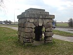
Hampole
Civil parishes in South YorkshireUse British English from November 2020Villages in Doncaster

Hampole is a small village and civil parish in the City of Doncaster in South Yorkshire, England, close to the border with West Yorkshire. Historically part of the West Riding of Yorkshire, the eastern boundary of the parish is marked by the Great North Road (now the A1), and the parish lies in what was once the Barnsdale Forest. It had a population of 187 in 2001, increasing to 203 at the 2011 Census, which includes the neighbouring village of Skelbrooke. Hampole lies on the A638 between Doncaster and Wakefield.
Excerpt from the Wikipedia article Hampole (License: CC BY-SA 3.0, Authors, Images).Hampole
Doncaster Road, Doncaster
Geographical coordinates (GPS) Address Nearby Places Show on map
Geographical coordinates (GPS)
| Latitude | Longitude |
|---|---|
| N 53.586016 ° | E -1.237426 ° |
Address
Doncaster Road
Doncaster Road
DN6 7EU Doncaster
England, United Kingdom
Open on Google Maps


