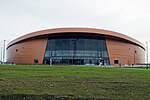
Saint-Quentin-en-Yvelines
Agglomeration communities in FranceIntercommunalities of YvelinesNew towns in Île-de-FranceNew towns started in the 1960sPages with French IPA ... and 4 more
Pages with disabled graphsPages with non-numeric formatnum argumentsPopulated places established in the 1960sSaint-Quentin-en-Yvelines

Saint-Quentin-en-Yvelines (French pronunciation: [sɛ̃ kɑ̃.tɛ̃ ɑ̃.n‿iv.lin]) is a new town and an agglomeration community in the French department of Yvelines. It is one of the original five villes nouvelles (new towns) of Paris and was named after the Saint Quentin Pond, which was chosen to become the town's centre. The town was built from a greenfield site starting in the 1960s. Its area is 119.2 km2. In 2018, Saint-Quentin-en-Yvelines had a population of 228,312. It is part of the much larger Paris metropolitan area, and is around 25 km (16 mi) west of the centre of Paris.
Excerpt from the Wikipedia article Saint-Quentin-en-Yvelines (License: CC BY-SA 3.0, Authors, Images).Saint-Quentin-en-Yvelines
Rue des Vanneaux, Versailles
Geographical coordinates (GPS) Address Nearby Places Show on map
Geographical coordinates (GPS)
| Latitude | Longitude |
|---|---|
| N 48.7881 ° | E 2.0446 ° |
Address
Gare de Saint-Quentin-en-Yvelines - Gare routière Delouvrier
Rue des Vanneaux
78180 Versailles
Ile-de-France, France
Open on Google Maps


