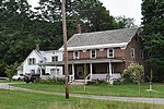
Bolton (CDP), Vermont
Census-designated places in Chittenden County, VermontCensus-designated places in VermontPopulated places in Chittenden County, VermontUse mdy dates from July 2023Vermont geography stubs
Bolton is the primary village and a census-designated place (CDP) in the town of Bolton, Chittenden County, Vermont, United States. It was first listed as a CDP prior to the 2020 census. The village is in eastern Chittenden County, on the north side of the valley of the Winooski River as it cuts through the center of the Green Mountains. The village is located along U.S. Route 2, which leads east 7 miles (11 km) to Waterbury and west 6 miles (10 km) to Richmond. Interstate 89 forms the northern edge of the community; the nearest access is from Exit 10 at Waterbury or Exit 11 at Richmond.
Excerpt from the Wikipedia article Bolton (CDP), Vermont (License: CC BY-SA 3.0, Authors).Bolton (CDP), Vermont
Theodore Roosevelt Highway,
Geographical coordinates (GPS) Address Nearby Places Show on map
Geographical coordinates (GPS)
| Latitude | Longitude |
|---|---|
| N 44.373055555556 ° | E -72.883611111111 ° |
Address
Theodore Roosevelt Highway 3033
05676
Vermont, United States
Open on Google Maps


