place

Keowee Key, South Carolina

Census-designated places in Oconee County, South CarolinaCensus-designated places in South CarolinaSouth Carolina geography stubsUse mdy dates from July 2023

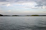
Keowee Key is a lakeside community and census-designated place (CDP) in Oconee County, South Carolina, United States. It is considered part of the Salem community. It was first listed as a CDP prior to the 2020 census with a population of 2,716.The CDP is on the eastern edge of Oconee County, on a peninsula extending into Lake Keowee, a reservoir on the Keowee River and Little River. The arm of the lake on the Little River borders the western side of the peninsula, while the Keowee River arm forms the eastern side and is the border with Pickens County. The two arms of the lake join via a small channel in the south part of the CDP; to the south, across the channel and outside the CDP, is the Oconee Nuclear Station power plant. The Keowee River is a south-flowing tributary of the Seneca River, a main tributary of the Savannah River. South Carolina Highways 130 and 183 traverse the CDP. SC 130 (Stamp Creek Road) leads northwest 8 miles (13 km) to Salem, while SC 183 (Pickens Highway) leads west 11 miles (18 km) to Walhalla, the Oconee county seat. The two highways merge to form Rochester Highway, which leaves the CDP to the south. SC 130 continues south down Rochester Highway 10 miles (16 km) to Seneca, and SC 183 turns east and leads 15 miles (24 km) to Pickens.

Excerpt from the Wikipedia article Keowee Key, South Carolina (License: CC BY-SA 3.0, Authors).

Keowee Key, South Carolina
Stamp Creek Road,

Geographical coordinates (GPS) Address Nearby Places
placeShow on map

Wikipedia: Keowee Key, South CarolinaContinue reading on Wikipedia

Geographical coordinates (GPS)

Latitude Longitude
N 34.826111111111 ° E -82.918333333333 °
placeShow on map

Address

Stamp Creek Road 1202
29676
South Carolina, United States
mapOpen on Google Maps

Share experience

Nearby Places

Lake Keowee
Lake Keowee

Lake Keowee is a man-made reservoir in the United States in the state of South Carolina. It was developed to serve the needs of power utility Duke Energy and public recreational purposes. It is approximately 26 miles (42 km) long, 3 miles (4.8 km) wide, with an average depth of 54 feet (16 m), and a shoreline measured at 300 miles (480 km) in total, and is approximately 800 feet (240 m) above sea level. The massive demolition and building project began in 1971 with the construction of two large dams––Keowee Dam and Little River Dam, built on the rivers of the same names. The project covered 18,372 acres (74.35 km2). The lake collects or impounds waters from the Keowee River and the Little River and others. The outflows below the respective dams join to form the Seneca River, which flows into the larger Savannah River. Lake water is used to cool Duke Energy's three nuclear reactors located at the Oconee Nuclear Generating Station. In addition, the dams help generate hydroelectric power. The Keowee Hydro Station generates 158 megawatts from the lake's outflows. Lake Keowee has provided a recreational destination for fishing, boating, swimming, sailing, kayaking and other watersports. The lake has been described as having pure and clean water. The name Keowee (ᎨᎣᏫ) is a Cherokee word: it is roughly translated as "place of the mullberries." The historic Keowee Town had been located on the bank of the Keowee River and was the largest of the seven Cherokee Lower Towns in the colonial period, in what became the state of South Carolina. Both the town and the former Keowee River were inundated by the formation of Lake Keowee. Archeological excavations conducted in advance of the project by the University of South Carolina recovered thousands of artifacts, as well as evidence of human and animal remains. There was a traditional burial ground at the town.