place

Keowee

Cherokee townsNative American history of South Carolina
Inundated 38Oc1
Inundated 38Oc1

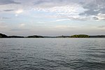
Keowee (Cherokee: ᎫᏩᎯᏱ, romanized: Guwahiyi) was a Cherokee town in the far northwest corner of present-day South Carolina. It was the principal town of what were called the seven Lower Towns, located along the Keowee River (Colonists referred to the lower reaches of the river as the Savannah in its lower reaches, with its mouth at the city they named Savannah). Keowee was situated on the Lower Cherokee Traders' Path, part of the Upper Road through the Piedmont. In 1752 the Cherokee established New Keowee Town nearby, off the traders' path but in a more defensible location. Both historic sites are within present-day Oconee County, South Carolina at the foot of the Blue Ridge Mountains. European Americans developed the town of Clemson, South Carolina, south of here after they began to populate the area. When the Keowee River was dammed in a mid-20th century hydropower project, both former Keowee sites were submerged in the early 1970s beneath the waters of Lake Keowee. Before that, archeological excavation was conducted by specialists from the University of South Carolina to establish history and recover thousands of artifacts. Human and animal remains were also discovered at the site.

Excerpt from the Wikipedia article Keowee (License: CC BY-SA 3.0, Authors, Images).

Keowee
Crystal Cove Trail,

Geographical coordinates (GPS) Address Nearby Places
placeShow on map

Wikipedia: KeoweeContinue reading on Wikipedia

Geographical coordinates (GPS)

Latitude Longitude
N 34.854722222222 ° E -82.915277777778 °
placeShow on map

Address

Crystal Cove Trail

Crystal Cove Trail
29676
South Carolina, United States
mapOpen on Google Maps

Inundated 38Oc1
Inundated 38Oc1
Share experience

Nearby Places

Lake Keowee
Lake Keowee

Lake Keowee is a man-made reservoir in the United States in the state of South Carolina. It was developed to serve the needs of power utility Duke Energy and public recreational purposes. It is approximately 26 miles (42 km) long, 3 miles (4.8 km) wide, with an average depth of 54 feet (16 m), and a shoreline measured at 300 miles (480 km) in total, and is approximately 800 feet (240 m) above sea level. The massive demolition and building project began in 1971 with the construction of two large dams––Keowee Dam and Little River Dam, built on the rivers of the same names. The project covered 18,372 acres (74.35 km2). The lake collects or impounds waters from the Keowee River and the Little River and others. The outflows below the respective dams join to form the Seneca River, which flows into the larger Savannah River. Lake water is used to cool Duke Energy's three nuclear reactors located at the Oconee Nuclear Generating Station. In addition, the dams help generate hydroelectric power. The Keowee Hydro Station generates 158 megawatts from the lake's outflows. Lake Keowee has provided a recreational destination for fishing, boating, swimming, sailing, kayaking and other watersports. The lake has been described as having pure and clean water. The name Keowee (ᎨᎣᏫ) is a Cherokee word: it is roughly translated as "place of the mullberries." The historic Keowee Town had been located on the bank of the Keowee River and was the largest of the seven Cherokee Lower Towns in the colonial period, in what became the state of South Carolina. Both the town and the former Keowee River were inundated by the formation of Lake Keowee. Archeological excavations conducted in advance of the project by the University of South Carolina recovered thousands of artifacts, as well as evidence of human and animal remains. There was a traditional burial ground at the town.