place

Singleton, West Sussex

Chichester DistrictVillages in West Sussex
Singleton
Singleton

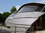
Singleton is a village, Anglican parish and civil parish in the Chichester district of West Sussex, England. It lies in the Lavant valley, 5 miles (8 km) miles north of Chichester on the A286 road to Midhurst. The civil parish has a land area of 1,602 hectares (3,960 acres). In the 2001 census there were 199 households containing 476 people, of whom 199 were economically active. The population marginally increased to 480 at the 2011 Census.

Excerpt from the Wikipedia article Singleton, West Sussex (License: CC BY-SA 3.0, Authors, Images).

Singleton, West Sussex
Papageienbrücke, Hannover Calenberger Neustadt (Südstadt-Bult)

Geographical coordinates (GPS) Address Nearby Places
placeShow on map

Wikipedia: Singleton, West SussexContinue reading on Wikipedia

Geographical coordinates (GPS)

Latitude Longitude
N 50.91066 ° E -0.75313 °
placeShow on map

Address

Papageienbrücke

Papageienbrücke
30169 Hannover, Calenberger Neustadt (Südstadt-Bult)
Niedersachsen, Deutschland
mapOpen on Google Maps

Singleton
Singleton
Share experience

Nearby Places

Goodwood Racecourse
Goodwood Racecourse

Goodwood Racecourse is a horse-racing track five miles north of Chichester, West Sussex, in England controlled by the family of the Duke of Richmond, whose seat is nearby Goodwood House. It hosts the annual Glorious Goodwood meeting in late July and early August, which is one of the highlights of the British flat racing calendar, and is home to three of the UK's 36 annual Group 1 flat races, the Sussex Stakes, the Goodwood Cup and the Nassau Stakes. Although the race meeting has become known as 'Glorious Goodwood', it is sponsored by Qatar and officially called the 'Qatar Goodwood Festival'. It is considered to enjoy an attractive setting to the north of Trundle Iron Age hill fort, which is used as an informal grandstand with views of the whole course. One problem is that its proximity to the coast means that it can get foggy. This is an unusual, complex racecourse with a straight six furlongs—the "Stewards' Cup Course"—which is uphill for the first furlong and mostly downhill thereafter. There is a tight right-handed loop at the far end of the straight on which there are starts for various longer distance courses. These include the 1 mile 2 furlongs (1m 2f) "Craven Course", the 1m 4f "Gratwicke Course" and the 1m 6f "Bentinck Course". The start for the 2m 5f "Cup Course" is quite close to the winning post—horses travel outwards on the straight, around the loop and back. Throughout the loop there are severe undulations and sharp turns. The course is used for flat racing only. From 1968 to 1970 the course's late summer meeting was shown on ITV, and from the early 2000s some races from the course occasionally appeared on Channel 4, but otherwise the course had been covered exclusively by the BBC for 50 years from 1956 (when it first appeared on television) to 2006. In 2007 the rights passed to Channel 4 Racing. Since 2017 races have been live on ITV Racing after the channel won the rights to televise horse racing from Channel 4. In the late 18th century, Goodwood became the location for the first flag start on a British racecourse, at the behest of Lord George Bentinck, after a particularly shambolic start involving jockey Sam Arnull caused by an elderly deaf starter with a speech impediment. Its primary meeting, now known as "Glorious Goodwood", was established in 1802 and the important early handicap the Goodwood Stakes was established in 1823.

The Trundle
The Trundle

The Trundle is an Iron Age hillfort on St Roche's Hill about 4 miles (6 km) north of Chichester, West Sussex, England, built on the site of a causewayed enclosure, a form of early Neolithic earthwork found in northwestern Europe. Causewayed enclosures were built in England from shortly before 3700 BC until at least 3500 BC; they are characterized by the full or partial enclosure of an area with ditches that are interrupted by gaps, or causeways. Their purpose is not known; they may have been settlements, meeting places, or ritual sites. Hillforts were built as early as 1000 BC, in the Late Bronze Age, and continued to be built through the Iron Age until shortly before the Roman occupation. A chapel dedicated to St Roche was built on the hill around the end of the 14th century; it was in ruins by 1570. A windmill and a beacon were subsequently built on the hill. The site was occasionally used as a meeting place in the post-medieval period. The hillfort is still a substantial earthwork, but the Neolithic site was unknown until 1925 when archaeologist O.G.S. Crawford obtained an aerial photograph of the Trundle, clearly showing additional structures inside the ramparts of the hillfort. Causewayed enclosures were new to archaeology at the time, with only five known by 1930, and the photograph persuaded archaeologist E. Cecil Curwen to excavate the site in 1928 and 1930. These early digs established a construction date of about 500 BC to 100 BC for the hillfort and proved the existence of the Neolithic site. In 2011, the Gathering Time project published an analysis of radiocarbon dates from almost forty British causewayed enclosures, including some from the Trundle. The conclusion was that the Neolithic part of the site was probably constructed no earlier than the mid-fourth millennium BC. A review of the site in 1995 by Alastair Oswald noted the presence of fifteen possible Iron Age house platforms within the hillfort's ramparts.