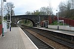
Tockholes

Tockholes is a village and civil parish which forms part of the Blackburn with Darwen unitary authority in the English county of Lancashire, England. Tockholes consists of the village of Tockholes itself and the hamlet of Ryal Fold, and has a population of 454, increasing to 478 at the 2011 Census. It lies on the West Pennine Moors and is surrounded by the towns of Blackburn to the north and Darwen to the east and by the villages of Belmont to the south and Withnell to the west. Darwen Tower is a prominent local landmark that lies to the east of Tockholes and the Roddlesworth Reservoirs and Tockholes forest plantation lie to the south with the M65 passing to the north. There are two churches: Tockholes United Reformed Church and Saint Stephen's Church.
Excerpt from the Wikipedia article Tockholes (License: CC BY-SA 3.0, Authors, Images).Tockholes
Coal Pit Lane,
Geographical coordinates (GPS) Address Nearby Places Show on map
Geographical coordinates (GPS)
| Latitude | Longitude |
|---|---|
| N 53.706 ° | E -2.508 ° |
Address
Coal Pit Lane
Coal Pit Lane
BB3 0NT , Tockholes
England, United Kingdom
Open on Google Maps


