place

Cherry Tree railway station
1847 establishments in EnglandBuildings and structures in BlackburnDfT Category F2 stationsFormer Lancashire and Yorkshire Railway stationsNorthern franchise railway stations
Railway stations in Blackburn with DarwenRailway stations in Great Britain opened in 1847Use British English from June 2017
Cherry Tree Station
Cherry Tree Station

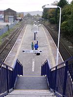
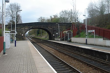
Cherry Tree railway station serves Cherry Tree in the Blackburn with Darwen borough of Lancashire, England. The station is 1.9 miles (3 km) southwest of Blackburn railway station. It is managed by Northern, who also provide all the passenger services calling there. The station is a two platform stop situated on the A674 road for Blackburn and was opened soon after the Blackburn to Preston line, in 1847. The former Lancashire Union Railway branch line to Chorley, Wigan and St Helens Shaw Street (opened in 1869) diverged a short distance to the west of the station, but this closed to passengers on 4 January 1960 and completely in 1966.The station is unstaffed, all of its permanent buildings having been demolished (shelters still survive on both platforms). Only the western end of each platform is now used, with the sections east of the bridge on both sides now derelict. It has been refurbished in recent years, with a Community Rail Lancashire and local authority-sponsored cleanup & repair project carried out by local schoolchildren, college students, volunteers and council workers in 2014. The station has a long-line PA system and digital information screens in place to provide train running information. It also has full step-free access to both platforms for disabled passengers.As of January 2018, along with other Stations on this line, a new touch screen Ticket Machine was added to the Station.

Excerpt from the Wikipedia article Cherry Tree railway station (License: CC BY-SA 3.0, Authors, Images).

Cherry Tree railway station
Green Lane,

Geographical coordinates (GPS) Address Nearby Places
placeShow on map

Wikipedia: Cherry Tree railway stationContinue reading on Wikipedia

Geographical coordinates (GPS)

Latitude Longitude
N 53.733 ° E -2.518 °
placeShow on map

Address

Green Lane

Green Lane
BB2 4SH , Cherry Tree
England, United Kingdom
mapOpen on Google Maps

Cherry Tree Station
Cherry Tree Station
Share experience

Nearby Places

River Blakewater, Lancashire

The River Blakewater is a river running through Lancashire, giving its name to the town of Blackburn. The Blakewater rises on the moors above Guide near Blackburn as Knuzden Brook and runs through the hamlet of that name, before taking the name Blakewater (meaning either "black water" or "clear water," the latter deriving from Old English blæc) near the village of Whitebirk. From there, the river runs through the Blackburn areas of Little Harwood, Cob Wall and Brookhouse to Blackburn town centre. The section of the Blakewater running through Blackburn town centre was culverted during the industrial revolution, and now runs underground. The culvert was extensively modified in the 1960s during the redevelopment of the town centre - it now runs underneath Ainsworth Street and between Blackburn Cathedral and Blackburn Bus Station. In recent years, the town has undergone a phase of regeneration with future proposals to open up parts of the culverted river so that the Blakewater will once again flow openly through areas of the town centre. On the western side of the town centre the Blakewater continues under Whalley Banks and through the Redlam area. The Blakewater joins the River Darwen outside Witton Country Park in Blackburn, which continues on to join the River Ribble at Walton-le-Dale. In addition to the aforementioned Knuzden Brook, the waters of the Blakewater are swelled by Little Harwood Brook (coming from Sunny Bower), Audley Brook (from the region of Queen's Park to the confluence near Darwen Street) and Snig Brook (which rises near Lammack and runs through Corporation Park).