place

Saint James, Trinidad and Tobago

Geography of Port of SpainVague or ambiguous time from January 2017
St.jamesuphigh
St.jamesuphigh

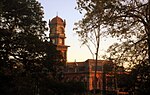
Saint James is a district of Port of Spain, Trinidad and Tobago. Port of Spain's last major municipal expansion occurred in 1938, when the St. James district north of Woodbrook and west of St. Clair was incorporated into the city limits. In the late 19th century, Indian indentured labourers on nearby sugar estates established houses here, and St. James gradually became the centre of Port of Spain's Indian population, with many streets named after cities and districts in British India. Western Main Road, the area's major thoroughfare, has long been the city's main nightlife district, sometimes nicknamed "the city that never sleeps". Long Circular Road, which curves north from Western Main Road then east to meet Maraval Road, forms part of the city boundary. Its "circle" encloses Flagstaff Hill, a small rise with the US ambassador's residence at its summit, which lends its name to an area of apartment buildings at its southern foot. South of St. James and near the seashore at Invaders Bay is Mucurapo, a mostly residential district which also contains the city's second-largest cemetery.

Excerpt from the Wikipedia article Saint James, Trinidad and Tobago (License: CC BY-SA 3.0, Authors, Images).

Saint James, Trinidad and Tobago
Queen's Park West, Port of Spain Newtown

Geographical coordinates (GPS) Address Nearby Places
placeShow on map

Wikipedia: Saint James, Trinidad and TobagoContinue reading on Wikipedia

Geographical coordinates (GPS)

Latitude Longitude
N 10.666666666667 ° E -61.516666666667 °
placeShow on map

Address

Amera

Queen's Park West 43
190130 Port of Spain, Newtown
Trinidad and Tobago
mapOpen on Google Maps

St.jamesuphigh
St.jamesuphigh
Share experience

Nearby Places

Port of Spain
Port of Spain

Port of Spain, officially the City of Port of Spain (also stylized Port-of-Spain), is the capital of Trinidad and Tobago and the third largest municipality, after Chaguanas and San Fernando. The city has a municipal population of 49,031 (2022 census), an urban population of 545,045 (2023 estimate) and a transient daily population of 250,000. It is located on the Gulf of Paria, on the northwest coast of the island of Trinidad and is part of a larger conurbation stretching from Chaguaramas in the west to Arima in the east with an estimated population of 600,000.The city serves primarily as a retail and administrative centre and it has been the capital of the island since 1757. It is also an important financial services centre for the Caribbean and is home to two of the largest banks in the region. The Piarco International Airport is the main airport on the island, connecting the capital to various major global destinations. Port of Spain was also the de facto capital of the short-lived West Indies Federation, which united the Caribbean. The city is also home to the largest container port on the island and is one of several shipping hubs of the Caribbean, exporting both agricultural products and manufactured goods. Bauxite from Guyana is trans-shipped via facilities at Chaguaramas, about 8 kilometres (5 mi) west of the city. The pre-lenten Carnival is the city's main annual cultural festival and tourist attraction. Today, Port of Spain is a leading city in the Caribbean region. Trinidad and Tobago hosted the Fifth Summit of the Americas in 2009, whose guests included US President Barack Obama and US Secretary of State Hillary Clinton.Port of Spain is also home to the biggest and most successful stock exchange in the Caribbean, the Trinidad and Tobago Stock Exchange (TTSE). The Nicholas Tower, as well as other skyscrapers, are well known throughout the region. These buildings dominate the city's skyline. Some of the tallest skyscrapers in the Caribbean are located in Port of Spain.

Magnificent Seven (Port of Spain)

The Magnificent Seven is a group of seven mansions located west of the Queen's Park Savannah in northern Port of Spain, Trinidad and Tobago on Maraval Road in the St Clair neighborhood. They were built between 1902 and 1910 on land that was previously used as a government stock farm and are listed as heritage sites at the National Trust of Trinidad and Tobago. Stollmeyer's Castle was the first building in the neighborhood and took several years to complete, as was typical of the Magnificent Seven. The structures were designed in an array of architectural styles including French Colonial, Scottish baronial, Indian Empire, and Moorish Mediterranean styles—often blended with Caribbean architecture. Many have unusual elements, like the chiming clock and lighted clock tower of Queen's Royal College. Stollmeyer's Castle is said to be modeled after a wing of Balmoral Castle. Hayes Court, a French Colonial style building, has contemporary Scottish cast iron elements and traditional Demerara windows. White Hall is made of natural white limestone of Barbados. Some of the structures were made of imported materials, like Italian marble and Scottish cast iron elements. Most were originally built as residences and kept within families for decades. Archbishop's House was built as, and remains, the official residence of the Archbishop of Port of Spain. The Anglican Bishop to Trinidad resided in Hayes Court. Queen's Royal College was built as a secondary school for boys. White Hall was used as the Office of the Prime Minister from 1963 to 2009. White Hall and Stollmeyer's Castle fall under the purview of the Office of the Prime Minister. The two buildings had restoration work so that they could be used by foreign dignitaries visiting Port of Spain. Both buildings were commandeered by the United States Armed Forces during World War II. Most of the Magnificent Seven Houses retain the aesthetics of the original designs. Of the buildings, Milles Fleur is the one most in disrepair due to extended periods where it was not occupied or maintained.