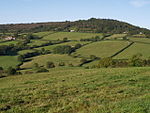
Coney's Castle

Coney's Castle is an Iron Age hillfort in Dorset, England. The name Coney is from the Old English for rabbit (Latin cuniculus), suggesting medieval use as a domestic warren, as at nearby Pilsdon Pen. The fort is on a narrow north–south ridge reaching a height of 210 m, with linear ramparts across the ridge, steep natural slopes to the west and a high artificial rampart with ditch to the east. A small lane runs along the ridge, bisecting the hillfort. The lane is also part of the Wessex Ridgeway long-distance trail. There is a convenient car park next to the north rampart. The remains of the hillfort are designated as a scheduled monument and was on the Heritage at Risk Register but was removed in 2022 as a result of the Hillforts and Habitats Project. The site is looked after by the National Trust as is Lambert's Castle about 1.5 km to the north.
Excerpt from the Wikipedia article Coney's Castle (License: CC BY-SA 3.0, Authors, Images).Coney's Castle
Coombe Drain,
Geographical coordinates (GPS) Address Nearby Places Show on map
Geographical coordinates (GPS)
| Latitude | Longitude |
|---|---|
| N 50.77367 ° | E -2.892 ° |
Address
Coney's Castle Hill Fort
Coombe Drain
DT6 6NR , Whitchurch Canonicorum
England, United Kingdom
Open on Google Maps


