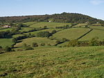
Wootton Fitzpaine
Villages in Dorset

Wootton Fitzpaine is a village and civil parish in the county of Dorset in South West England. It lies approximately 3 miles (4.8 km) north-east of Lyme Regis in a small side valley of the River Char, close to the Marshwood Vale. The civil parish covers an area of 3,307 acres (1,338 ha) and includes the ecclesiastical parish and small settlement of Monkton Wyld to the west. In the 2011 census the civil parish had 180 dwellings, 134 households and a population of 345.
Excerpt from the Wikipedia article Wootton Fitzpaine (License: CC BY-SA 3.0, Authors, Images).Wootton Fitzpaine
Wootton Lane,
Geographical coordinates (GPS) Address Nearby Places Show on map
Geographical coordinates (GPS)
| Latitude | Longitude |
|---|---|
| N 50.758 ° | E -2.892 ° |
Address
Wootton Lane
Wootton Lane
DT6 6NH , Wootton Fitzpaine
England, United Kingdom
Open on Google Maps


