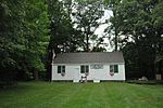
Turner (CDP), Maine
Census-designated places in Androscoggin County, MaineCensus-designated places in MaineMaine geography stubsUse mdy dates from July 2023
Turner is a census-designated place (CDP) and the primary village in the town of Turner, Androscoggin County, Maine, United States. It is in the center of the town, situated on the Nezinscot River, a northeast-flowing tributary of the Androscoggin River. Maine State Routes 4 and 117 cross just west of the center of the village. Route 4 (Auburn Road) leads north 17 miles (27 km) to Livermore Falls and south 11 miles (18 km) to Auburn, while Route 117 leads northwest 6 miles (10 km) to Buckfield and northeast 6 miles to Howes Corner in the northern part of the town of Turner. Turner was first listed as a CDP prior to the 2020 census.
Excerpt from the Wikipedia article Turner (CDP), Maine (License: CC BY-SA 3.0, Authors).Turner (CDP), Maine
North Main Street,
Geographical coordinates (GPS) Address Nearby Places Show on map
Geographical coordinates (GPS)
| Latitude | Longitude |
|---|---|
| N 44.256388888889 ° | E -70.256111111111 ° |
Address
North Main Street 3
04282
Maine, United States
Open on Google Maps


