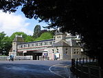
Chelston, Torquay

Chelston is an area of Torquay, Devon, England, and one of the town's most historic and best preserved Victorian suburbs, with many of the area's typical red sandstone buildings designated within the Chelston Conservation Area. Its statistical area is part of the Cockington with Chelston ward, which includes the neighbouring areas of Cockington and Livermead. The population of the entire ward is 7,951 as of 2018.The modern day area of Chelston is located almost entirely west of the Riviera Line railway tracks, with its northern boundaries taking in the lower half of Queensway and Sherwell Valley, bordered to the west with Cockington Village, and to the south by Corbyn Head and the sea.
Excerpt from the Wikipedia article Chelston, Torquay (License: CC BY-SA 3.0, Authors, Images).Chelston, Torquay
Walnut Road,
Geographical coordinates (GPS) Address Nearby Places Show on map
Geographical coordinates (GPS)
| Latitude | Longitude |
|---|---|
| N 50.463 ° | E -3.55 ° |
Address
St Matthew's Church
Walnut Road
TQ2 6HS , Chelston
England, United Kingdom
Open on Google Maps


