Rivière des Poitras
Geographic coordinate listsLists of coordinatesMontmagny Regional County MunicipalityRivers of Chaudière-Appalaches
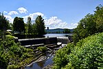
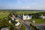
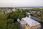
The rivière des Poitras is a tributary of the south bank of the Morigeau River which flows on the south-eastern bank of the rivière du Sud (Montmagny); the latter flows north-east to the south shore of the St. Lawrence River. The Poitras river flows in the municipalities of Saint-Pierre-de-la-Rivière-du-Sud and Saint-François-de-la-Rivière-du-Sud, in the Montmagny Regional County Municipality, in the administrative region of Chaudière-Appalaches, in Quebec, in Canada.
Excerpt from the Wikipedia article Rivière des Poitras (License: CC BY-SA 3.0, Authors).Rivière des Poitras
Chemin de l'Aqueduc,
Geographical coordinates (GPS) Address Nearby Places Show on map
 Continue reading on Wikipedia
 Geographical coordinates (GPS)
| Latitude | Longitude |
|---|---|
| N 46.86722 ° | E -70.65388 ° |
Address
Chemin de l'Aqueduc 87
Quebec, Canada
Open on Google Maps