place

Chenal des Grands Voiliers

Rivers of Capitale-Nationale

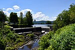
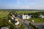
The Chenal des Grands Voiliers (English: channel of tall sailships) is a channel of the St. Lawrence River, between Île d'Orléans and the south shore of Quebec, in the province of Quebec, in Canada. On the southeast shore of Île d'Orléans, this channel successively wets the municipalities of Sainte-Pétronille, Saint-Laurent-de-l'Île-d'Orléans, Saint-Jean-de-l'Île-d'Orléans and Saint-François-de-l'Île-d'Orléans in L'Île-d'Orléans Regional County Municipality, in the administrative region of Capitale-Nationale. On the south shore of Quebec, the channel anchors the town of Lévis, Saint-Michel-de-Bellechasse and Berthier-sur-Mer in Bellechasse Regional County Municipality in the Chaudière-Appalaches region. Oceanic vessels use this passage to go up the St. Lawrence River to the Great Lakes. During the history, this channel was the scene of many shipwrecks. It was a must in order to enter the heart of America, via the St. Lawrence River. The channel is formed by Île d'Orléans (length: 33.1 kilometres (20.6 mi); width: 8.3 kilometres (5.2 mi)) which is bounded to the southeast by the St. Lawrence River and by the south shore of Quebec, between Lévis and Berthier-sur-Mer. In winter, the channel is cleared of ice by federal icebreakers.

Excerpt from the Wikipedia article Chenal des Grands Voiliers (License: CC BY-SA 3.0, Authors).

Chenal des Grands Voiliers

Geographical coordinates (GPS) Address Nearby Places
placeShow on map

Wikipedia: Chenal des Grands VoiliersContinue reading on Wikipedia

Geographical coordinates (GPS)

Latitude Longitude
N 46.96773 ° E -70.7278 °
placeShow on map

Address

Montmagny (MRC)


Quebec, Canada
mapOpen on Google Maps

Share experience

Nearby Places

Grosse Isle
Grosse Isle

Grosse Isle (French: Grosse Île, "big island") is an island located in the St. Lawrence River in Quebec, Canada. It is one of the islands of the 21-island Isle-aux-Grues archipelago. It is part of the municipality of Saint-Antoine-de-l'Isle-aux-Grues, located in the Chaudière-Appalaches region of the province. Also known as Grosse Isle(the famine) and the Irish Memorial National Historic Site, the island was the site of an immigration depot which housed predominantly Irish immigrants coming to Canada to escape the Great Famine of 1845–1849. In 1832, the Lower Canadian Government had previously set up this depot to contain an earlier cholera epidemic that was believed to be caused by the large influx of European immigrants, and the station was reopened in the mid-19th century to accommodate Irish immigrants who had contracted typhus during their voyages. Thousands of Irish were quarantined on Grosse Isle from 1832 to 1848. It is believed that over 3,000 Irish people died on the island and that over 5,000 are currently buried in the cemetery there; many died en route. Most who died on the island were infected with typhus, a result of poor sanitary conditions there in 1847. Grosse Isle is the largest burial ground for refugees of the Great Famine outside Ireland. After Canadian Confederation in 1867, the buildings and equipment were modernized to meet the standards of the new Canadian government's immigration policies. Grosse Isle is sometimes referred to as Canada's Ellis Island (1892–1954), an association it shares with the Pier 21 immigration facility in Halifax, Nova Scotia. It is estimated that in total, from its opening in 1832 to its closing in 1932, almost 500,000 Irish immigrants passed through Grosse Isle on their way to Canada.