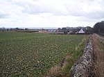
Carmyllie
Angus geography stubsUse British English from March 2017Villages in Angus, Scotland

Carmyllie (Gaelic: Càrn Mhoillidh) is a rural parish in Angus, Scotland. It is situated on high ground between Arbroath, on the coast, and the inland county town of Forfar. The main settlements in the parish are Redford, Greystone, Guynd and Milton of Carmyllie. There is a Church of Scotland church and a primary school. The Elliot Water rises in the west of the parish.
Excerpt from the Wikipedia article Carmyllie (License: CC BY-SA 3.0, Authors, Images).Carmyllie
B961,
Geographical coordinates (GPS) Address Nearby Places Show on map
Geographical coordinates (GPS)
| Latitude | Longitude |
|---|---|
| N 56.568364 ° | E -2.731575 ° |
Address
Milton Haugh Farm Shop
B961
DD11 2QS , Letham & District
Scotland, United Kingdom
Open on Google Maps


