Lambert's Point Deperming Station

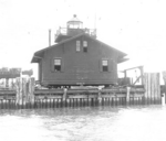
Lambert's Point Deperming Station is a United States Navy deperming facility located in the Elizabeth River just off Lambert's Point, Norfolk, Virginia, United States. It was built in the mid-1940s and services the U.S. Atlantic Fleet. The station, which is administered by Naval Station Norfolk, consists of two parallel pile-supported piers, roughly 1140 ft. (345 m.) in length, which form a slip that can accommodate all Navy and Coast Guard ships up to and including the largest warships afloat, the Nimitz class aircraft carriers. There is a second pier for smaller vessels and support craft. The station has administrative offices and a medical clinic on site. When viewed from the air, the pier configuration resembles the number 41.
Excerpt from the Wikipedia article Lambert's Point Deperming Station (License: CC BY-SA 3.0, Authors, Images).Lambert's Point Deperming Station
Western Freeway, Portsmouth
Geographical coordinates (GPS) Address Nearby Places Show on map
Geographical coordinates (GPS)
| Latitude | Longitude |
|---|---|
| N 36.8671 ° | E -76.3324 ° |
Address
Western Freeway
23707 Portsmouth
Virginia, United States
Open on Google Maps


