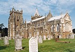
Feniton

Feniton is a village and civil parish in East Devon in the English county of Devon. The village lies about 4 miles (6.4 km) west of Honiton, 3 miles (4.8 km) north of Ottery St Mary, and 2 miles (3.2 km) east of Talaton. The parish of Feniton incorporates the hamlets of Colesworthy, Higher Cheriton and Curscombe. It covers an area of 644 hectares (1591 acres), and is surrounded, clockwise from the north, by the parishes of Payhembury, Buckerell, Gittisham, Ottery St Mary and Talaton. At the 2001 census the parish had a population of 1,796, decreasing to 1,568 at the 2011 Census.The 2012 draft East Devon Local Plan recorded 716 houses within the Built Up Area Boundary. Feniton is a major part of the electoral ward called "Feniton and Buckerell". The total population of this ward at the 2011 census was 2,274.
Excerpt from the Wikipedia article Feniton (License: CC BY-SA 3.0, Authors, Images).Feniton
York Crescent, East Devon Feniton
Geographical coordinates (GPS) Address Nearby Places Show on map
Geographical coordinates (GPS)
| Latitude | Longitude |
|---|---|
| N 50.78661 ° | E -3.28257 ° |
Address
York Crescent
York Crescent
EX14 3DZ East Devon, Feniton
England, United Kingdom
Open on Google Maps


