place

Whitestone station

Former Long Island Rail Road stations in New York CityNew York City railway station stubsQueens, New York building and structure stubsRailway stations in Queens, New YorkRailway stations in the United States opened in 1869
Use mdy dates from July 2021Whitestone, Queens

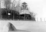
Whitestone station was located on the Whitestone Branch of the Long Island Rail Road in Whitestone, in Queens of New York City. The station was located on 15th Avenue (which later became the eastbound service road on the Cross Island Parkway which ran on the Branch's Right-of-way) from 149th Street to 150th Street. It connected to the Whitestone Trolley. The station had a coal pocket underneath it and shipped some of it out.

Excerpt from the Wikipedia article Whitestone station (License: CC BY-SA 3.0, Authors).

Whitestone station
Cross Island Parkway, New York Queens County

Geographical coordinates (GPS) Address Nearby Places
placeShow on map

Wikipedia: Whitestone stationContinue reading on Wikipedia

Geographical coordinates (GPS)

Latitude Longitude
N 40.787222222222 ° E -73.814444444444 °
placeShow on map

Address

Cross Island Parkway

Cross Island Parkway
11357 New York, Queens County
New York, United States
mapOpen on Google Maps

Share experience

Nearby Places

Flushing Fields

Flushing Fields is a public park in the northern section of the Flushing neighborhood of Queens in New York City. The site of this park was purchased by the Memorial Field of Flushing Corporation in 1921 at what was at the time open farmland. From its beginning, the park served as the home field for the softball, soccer, football and track teams from Flushing High School. The name of the park and monument at its southern section honor residents of Flushing killed in the First World War. In 1930, the income generated by sports games at Memorial Field failed to meet the tax burden for the property and its owners approached the City, offering to transfer a portion of the field to the Parks Department as a playground. The central section of the property, containing an athletic field and grandstand was transferred in the following year to the Board of Education for continued use by Flushing High School. In 1935, the bequest of Flushing Fields to the City was recorded and an Art Moderne-style memorial was completed on the southern portion of the property. The Flushing War Memorial is unique in that it honors both men and women. Its location in a public park not only recognized the individuals who died but also serves as a constant reminder to the neighborhood of the great sacrifice made by local residents for the county. The granite stele carries a bronze plaque inscribed with 70 names and a quote from the Gospel of John 15:13. "Greater love hath no man than this that a man lay down his life for his friends." Following the City’s acquisition of Flushing Fields, the site was divided into three sections, the Memorial Field of Flushing on Bayside Avenue, which contains the Flushing War Memorial, the Flushing High School Memorial Field in the center, and the Leonardo Ingravallo Playground on the northern section of the site. The playground contains a baseball field, two softball fields, courts for basketball, handball and tennis, and a playground. The playground was reconstructed in 1995 and the ballfield in 2003, updating the play equipment with safety features and improved drainage. Flushing Fields remains a popular venue for organized sports in Flushing, a lasting gift to the city by the neighborhood’s residents.

Bronx–Whitestone Bridge

The Bronx–Whitestone Bridge (colloquially referred to as the Whitestone Bridge or simply the Whitestone) is a suspension bridge in New York City, carrying six lanes of Interstate 678 over the East River. The bridge connects Throggs Neck and Ferry Point Park in the Bronx, on the East River's northern shore, with the Whitestone neighborhood of Queens on the southern shore. Although the Bronx–Whitestone Bridge's construction was proposed as early as 1905, it was not approved until 1936. The bridge was designed by Swiss-American architect Othmar Ammann and design engineer Allston Dana and opened to traffic with four lanes on April 29, 1939. The bridge's design was similar to that of the Tacoma Narrows Bridge, which collapsed in 1940. As a result, extra stiffening trusses were added to the Bronx–Whitestone Bridge in the early 1940s, and it was widened to six lanes during the same project. The Bronx–Whitestone Bridge was also renovated in 1988–1991 to repair the anchorages, roadways, and drainage. The stiffening trusses were removed during a renovation in the mid-2000s, and the bridge's deck and approach viaducts were replaced soon afterward. The Bronx–Whitestone Bridge is owned by New York City and operated by MTA Bridges and Tunnels, an affiliate agency of the Metropolitan Transportation Authority. With a center span of 2,300 feet (700 m), the Bronx–Whitestone Bridge once had the fourth-largest center span of any suspension bridge in the world. The bridge has a total length of 3,700 feet (1,100 m), and its towers reach 377 feet (115 m) above water level.

Travis Triangle
Travis Triangle

Travis Triangle is a narrow green space in the Murray Hill/Flushing neighborhoods of Queens, New York City. It is formed by the separation of Murray Street and Murray Lane, both of which were named after the Murray family, which owned land on the site of these streets from the late colonial period through the early 19th century. In 1932, New York City's Board of Aldermen passed a resolution to name this site Travis Triangle in honor of local American Civil War veteran Ira Underhill Travis (1839-1921), who fought under the name Ira Wilson, in the 11th New York Volunteer Infantry Regiment also known as Colonel Elmer E. Ellsworth’s Zouaves.In the incident at Marshall House Inn during the Union Army's occupation of Alexandria, Virginia, his commander was killed after removing a Confederate flag. Travis kept a piece of the flag as a souvenir for his family In July 1861, Travis received a bullet wound in his shoulder in the First Battle of Manassas. The bullet remained lodged in his shoulder for the rest of his life. Travis was buried at Flushing Cemetery.With the arrival of the subway to Flushing in 1928, the neighborhood expanded to the north and east and parks were built to accommodate the new residents. Parcels that were too small to develop, such as this site, were designated as green spaces maintained by the city's Parks Department. The park contains plots for 24 trees and a bench on its northern side. Continuing north, Murray Lane gradually narrows, taking on the appearance of a countryside lane, having changed little as the surrounding neighborhood transformed over a century from farmland towards residential.