West Drayton, Nottinghamshire
Bassetlaw DistrictCivil parishes in NottinghamshireVillages in Nottinghamshire

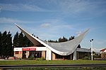
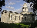
West Drayton is a village and civil parish in the Bassetlaw district in the county of Nottinghamshire, England. It lies 24 miles (39 km) north east of Nottingham and 4 miles (6.4 km) south of Retford. In 2011 the parish had a population of 225. The parish includes the villages of Rockley and Markham Moor. West Drayton was originally known simply as Drayton, and was recorded under that name in the Domesday Book of 1086. "West" was added to distinguish the place from the village of East Drayton, 4 miles east. St Paul's Church dates back to the 12th century, but was rebuilt in 1874. It is a Grade II* listed building.
Excerpt from the Wikipedia article West Drayton, Nottinghamshire (License: CC BY-SA 3.0, Authors, Images).West Drayton, Nottinghamshire
Old London Road, Bassetlaw West Drayton
Geographical coordinates (GPS) Address Nearby Places Show on map
Geographical coordinates (GPS)
| Latitude | Longitude |
|---|---|
| N 53.2635 ° | E -0.9386 ° |
Address
Old London Road
Old London Road
DN22 8ED Bassetlaw, West Drayton
England, United Kingdom
Open on Google Maps


