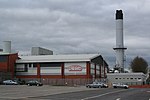
Pemberton, Greater Manchester

Pemberton is a town and an electoral ward of the Metropolitan Borough of Wigan, in Greater Manchester, England. It lies on the southwestern bank of the River Douglas, which separates it from the town of Wigan, and east of the M6 motorway. The area today serves as a predominantly residential suburb along with the adjoining area of Orrell and as a ward has a population of 13,638, increasing to 13,982 at the 2011 Census.Historically a part of Lancashire, Pemberton was formerly a township and parish in the hundred of West Derby. Following the Industrial Revolution, Pemberton became a densely populated industrial district comprising a variety of coal mines, stone-quarries, brick manufactories, and cotton mills. Coal mining was the principal industry of what was described in 1911 as an "unpicturesque, bare and open" area. The former Pemberton Urban District, along with Wigan Municipal Borough to form the County Borough of Wigan in 1904.
Excerpt from the Wikipedia article Pemberton, Greater Manchester (License: CC BY-SA 3.0, Authors, Images).Pemberton, Greater Manchester
Geographical coordinates (GPS) Address Nearby Places Show on map
Geographical coordinates (GPS)
| Latitude | Longitude |
|---|---|
| N 53.536 ° | E -2.6738 ° |
Address
WN5 9JY , Pemberton
England, United Kingdom
Open on Google Maps


