Mount Kent (Washington)
Cascade RangeMount Baker-Snoqualmie National ForestMountains of King County, WashingtonMountains of Washington (state)North American 1000 m summits

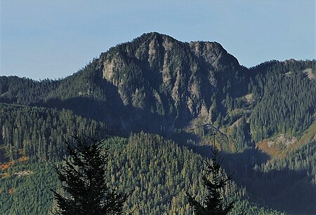
Mount Kent is a 5,087-foot (1,551-metre) mountain summit located in east King County of Washington state. It's part of the Cascade Range and is situated on land managed by Mount Baker-Snoqualmie National Forest. Precipitation runoff on the mountain drains north into Alice Creek, a tributary of the South Fork Snoqualmie River. The nearest higher neighbor is McClellan Butte, 1.16 mi (1.87 km) to the north, and Mount Defiance is set 4 mi (6.4 km) to the northeast across the Interstate 90 corridor.
Excerpt from the Wikipedia article Mount Kent (Washington) (License: CC BY-SA 3.0, Authors, Images).Mount Kent (Washington)
Geographical coordinates (GPS) Address Nearby Places Show on map
Geographical coordinates (GPS)
| Latitude | Longitude |
|---|---|
| N 47.390338 ° | E -121.617764 ° |
Address
King County
Washington, United States
Open on Google Maps


