place

Aleksanterinkatu (Tampere)

Europe road stubsKyttäläStreets in TampereWestern Finland Province geography stubs
Aleksanterinkatu Tampere

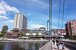
Aleksanterinkatu ("Alexander Street") is a street in the Kyttälä district, in the centre of Tampere, Finland. It is a north–south street, which is one of the cross streets of Hämeenkatu, Tampere's main street. In the south, it intersects the Hatanpää highway at Sori Square and ends in the north at Erkkilänaukee in Jussinkylä, near Tampere Cathedral. Like most streets in Kyttälä, Aleksanterinkatu was named in 1877, when the area was annexed to the city of Tampere and a town plan was approved. However, the town plan was not put into practice until the 1890s, when the 15-year lease granted to the old inhabitants of the area expired. The name Aleksanterinkatu presumably refers to Tsar Alexander II of Russia, who had confirmed Tampere's free city rights unchanged for a new 50-year period in 1855.Aleksanterinkatu is also the name of the main street in many other Finnish cities, e.g.: Helsinki, Lahti, Oulu, Porvoo and Loviisa.

Excerpt from the Wikipedia article Aleksanterinkatu (Tampere) (License: CC BY-SA 3.0, Authors, Images).

Aleksanterinkatu (Tampere)
Aleksanterinkatu, Tampere Kyttälä (Keskustan suuralue)

Geographical coordinates (GPS) Address Nearby Places
placeShow on map

Wikipedia: Aleksanterinkatu (Tampere)Continue reading on Wikipedia

Geographical coordinates (GPS)

Latitude Longitude
N 61.499452777778 ° E 23.768227777778 °
placeShow on map

Address

Aleksanterinkatu 21
33100 Tampere, Kyttälä (Keskustan suuralue)
Finland
mapOpen on Google Maps

Aleksanterinkatu Tampere
Share experience

Nearby Places

Koskipuisto
Koskipuisto

Koskipuisto (Finnish for "rapids park") is a park in Kyttälä, Tampere, Finland, to the east of the Tammerkoski rapids. On the opposite shore of the rapids is the Kirjastonpuisto park - which is sometimes considered part of Koskipuisto.: 12 : 39–42  The Tammerkoski rapids with its coasts belongs to the national landscapes of Finland. The coast was designated as a park already in the first zoning plan of Kyttälä made by architect F. L. Calonius in 1886. Construction of the park started in the 1890s together with the renovation of Kyttälä, and it was completed at the turn of the century. The park reached as far as south of Hämeenkatu, but the construction of the Hatanpään valtatie road and the new Hämeensilta bridge significantly contracted its southern part. Nowadays the park area south of Hämeenkatu is known as Verkatehtaanpuisto.: 39–42 In the 1930s Koskipuisto was renovated and expanded, when the new Keskiputous power plant was built on Tammerkoski and the riverbed was narrowed. Land exposed by the narrowed riverbed was used to build a broader coast promenade. The old edge of the coast was located approximately in the middle of the current park.: 13–16  In 1971 the sculpture Virvatulet (meaning "wills-o'-the-wisp") by sculptor Aimo Tukiainen, dedicated to Finnish soldiers, was unveiled at the park.: 39–42  The park had previously hosted Yrjö Liipola's 1947 sculpture Paimenpoika ("the shepherd"), which was now moved to Verkatehtaanpuisto.: 31 In the early 1990s the play area of the park was renovated and named as the Pikku Kakkonen play park.