West Harton
Suburbs of South ShieldsTyne and Wear geography stubs
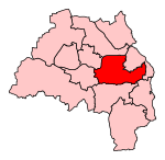
West Harton is an area of the town of South Shields, in Tyne and Wear, England. It is primarily a residential area, with several schools and leisure facilities, including St Wilfrid's College and Brinkburn Recreation Ground. South Tyneside District Hospital is also situated in the area. It is served by Tyne Dock Metro station on the Tyne and Wear Metro.
Excerpt from the Wikipedia article West Harton (License: CC BY-SA 3.0, Authors).West Harton
Marigold Walk, South Tyneside West Harton
Geographical coordinates (GPS) Address Nearby Places Show on map
Geographical coordinates (GPS)
| Latitude | Longitude |
|---|---|
| N 54.972 ° | E -1.443 ° |
Address
Marigold Walk
Marigold Walk
NE34 0BW South Tyneside, West Harton
England, United Kingdom
Open on Google Maps


