South Tyneside

South Tyneside is a metropolitan borough in the metropolitan county of Tyne and Wear, England. It is bordered by all four other boroughs in Tyne and Wear: Gateshead to the west, Sunderland in the south, North Tyneside to the north and Newcastle upon Tyne to the north-west. The border county of Northumberland lies further north. The borough was formed on 1 April 1974 by the merger of the County Borough of South Shields with the municipal borough of Jarrow and the urban districts of Boldon and Hebburn from County Durham. Part of the Tyneside conurbation, the sixth largest in the United Kingdom, South Tyneside has a geographical area of 24.88 sq mi (64.4 km2) and an estimated population of 153,700 (mid-year 2010), measured at the 2011 Census as 148,127. It is bordered to the east by the North Sea and to the north by the River Tyne. A Green Belt of 9.13 sq mi (23.6 km2) is at its southern boundary. The main administrative centre and largest town is South Shields. Other riverside towns are Jarrow and Hebburn, while the villages of Cleadon, Whitburn and The Boldons border the South Tyneside green belt, with Wearside to the south at Sunderland. South Tyneside is represented by two Members of Parliament in two constituencies: South Shields (including Whitburn) and Jarrow and Gateshead East (which also serves Hebburn, the urban fringe villages, and the eastern parts of Gateshead).
Excerpt from the Wikipedia article South Tyneside (License: CC BY-SA 3.0, Authors, Images).South Tyneside
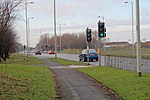
Benton Road, South Tyneside Brockley Whins
Geographical coordinates (GPS) Address Nearby Places Show on map
Geographical coordinates (GPS)
| Latitude | Longitude |
|---|---|
| N 54.959 ° | E -1.438 ° |
Address
Benton Road
Benton Road
NE34 9UB South Tyneside, Brockley Whins
England, United Kingdom
Open on Google Maps


