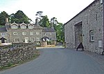
Witherslack, Meathop and Ulpha
Civil parishes in CumbriaCumbria geography stubsSouth Lakeland District

Witherslack, Meathop and Ulpha is a civil parish in the South Lakeland district of the English county of Cumbria. Historically in Westmorland, it is located 3.6 miles (5.8 km) north east of Grange-over-Sands and 10.6 miles (17.1 km) south west of Kendal, between the confluence of the River Kent estuary and the River Winster. It was created following the amalgamation of former civil parishes Witherslack and Meathop and Ulpha on 1 April 2015. In 2011 there was a total population of 653. It includes the villages of Witherslack and Meathop.
Excerpt from the Wikipedia article Witherslack, Meathop and Ulpha (License: CC BY-SA 3.0, Authors, Images).Witherslack, Meathop and Ulpha
Geographical coordinates (GPS) Address Nearby Places Show on map
Geographical coordinates (GPS)
| Latitude | Longitude |
|---|---|
| N 54.22 ° | E -2.863 ° |
Address
LA11 6RE , Witherslack, Meathop and Ulpha
England, United Kingdom
Open on Google Maps


