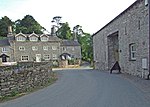
Meathop and Ulpha

Meathop and Ulpha is a former civil parish, now in the parish of Witherslack, Meathop and Ulpha, in the South Lakeland district of the English county of Cumbria. Historically in Westmorland, it is located 3.6 miles (5.8 km) north east of Grange-over-Sands, 10.6 miles (17.1 km) south west of Kendal and 64.0 miles (103.0 km) south of Carlisle, between the confluence of the River Kent estuary and the River Winster. In 2001 it had a population of 143, increasing slightly to 154 at the Census 2011. It included the village of Meathop. There were two Sites of Special Scientific Interest in the parish: Meathop Moss is a raised peat-bog designated an SSSI for its biological interest. Leased by the Society for the Promotion of Nature Reserves in 1919, it now belongs to the Cumbria Wildlife Trust. Meathop Woods and Quarry, which consists of woodland and a disused quarry on the side of a hill, has biological and geological interest.
Excerpt from the Wikipedia article Meathop and Ulpha (License: CC BY-SA 3.0, Authors, Images).Meathop and Ulpha
Geographical coordinates (GPS) Address Nearby Places Show on map
Geographical coordinates (GPS)
| Latitude | Longitude |
|---|---|
| N 54.22 ° | E -2.863 ° |
Address
LA11 6RE , Witherslack, Meathop and Ulpha
England, United Kingdom
Open on Google Maps


