English River (Chateauguay River tributary)

The English River (French: rivière des Anglais in Canada) is a tributary of the Chateauguay River. This cross-border river between Canada and the United States crosses: Clinton County, in New York State, United States; Les Jardins-de-Napierville Regional County Municipality, including Hemmingford in Montérégie, in Quebec, Canada; Le Haut-Saint-Laurent Regional County Municipality, including the municipalities of Havelock, Saint-Chrysostome and Très-Saint-Sacrement, in Montérégie. In the state of New York, the English River course is mainly served by Drown Road, White Road (east-west direction), Davison Road (east-west direction) and Blackman Corners Road (CR 16) (north direction -South). In Canada, the course of the English River is mainly served mainly by the route 203 (chemin du rang du Moulin, chemin du rang Sainte-Anne). The river surface is generally frozen from mid-December to the end of March. Safe circulation on the ice is generally done from the end of December to the beginning of March. The water level of the river varies with the seasons and the precipitation.
Excerpt from the Wikipedia article English River (Chateauguay River tributary) (License: CC BY-SA 3.0, Authors, Images).English River (Chateauguay River tributary)
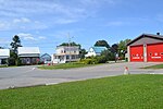
Route 138, Très-Saint-Sacrement
Geographical coordinates (GPS) Address Nearby Places Show on map
Geographical coordinates (GPS)
| Latitude | Longitude |
|---|---|
| N 45.213333333333 ° | E -73.830555555556 ° |
Address
Route 138
Route 138
Très-Saint-Sacrement
Quebec, Canada
Open on Google Maps


