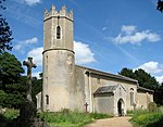
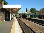
Thurlton

Thurlton is a small village in South Norfolk, located 14 miles (22 km) south-east of the city of Norwich, and 9 miles (15 km) west of the Suffolk coastal town of Lowestoft. The villages name means 'Thorferth's farm/settlement'. Thurlton is on the edge of the Broadland marshes to the south of the River Yare, and is bordered by Norton Subcourse to the west of the river. The population of the parish at the 2001 census was 720, increasing to 779 at the 2011 Census. The area around the village is mainly agricultural. Thurlton is home to the Great Goliath Mill, a brick built windmill. The village has basic amenities, including a pub, shop and post office. Thurlton Primary School has about 100 pupils, including a ‘classroom of the future’ extension, complete with a wind turbine.
Excerpt from the Wikipedia article Thurlton (License: CC BY-SA 3.0, Authors, Images).Thurlton
Church Road, South Norfolk Thurlton
Geographical coordinates (GPS) Address Nearby Places Show on map
Geographical coordinates (GPS)
| Latitude | Longitude |
|---|---|
| N 52.5287 ° | E 1.56349 ° |
Address
Church Road
Church Road
NR14 6SH South Norfolk, Thurlton
England, United Kingdom
Open on Google Maps


