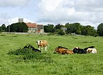
Upton Cow Down
English Site of Special Scientific Interest stubsSites of Special Scientific Interest in WiltshireWiltshire geography stubs

Upton Cow Down (grid reference ST875491) is a 16.4 hectare biological Site of Special Scientific Interest in Wiltshire. The down is an area of chalk grassland on the western edge of Salisbury Plain. It lies one mile south of the town of Westbury, above the village of Upton Scudamore.
Excerpt from the Wikipedia article Upton Cow Down (License: CC BY-SA 3.0, Authors, Images).Upton Cow Down
Imber Range Path,
Geographical coordinates (GPS) Address Nearby Places Show on map
Geographical coordinates (GPS)
| Latitude | Longitude |
|---|---|
| N 51.24094 ° | E -2.18045 ° |
Address
Imber Range Path
Imber Range Path
BA12 0AD , Upton Scudamore
England, United Kingdom
Open on Google Maps


