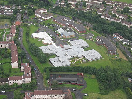
Drumchapel (Scottish Gaelic: Druim a' Chapaill), known locally as 'The Drum', is a district in the north-west of the city of Glasgow, Scotland. It borders Bearsden (in East Dunbartonshire) to the north-east and Drumry (part of Clydebank, in West Dunbartonshire) to the south-west, as well as Blairdardie, Garscadden, Knightswood and Yoker in Glasgow to the south; land to the north (including the Garscadden Woodlands) is undeveloped and includes the course of the Roman-era Antonine Wall. The name derives from the Gaelic meaning 'the ridge of the horse'.
As part of the overspill policy of Glasgow Corporation, a huge housing estate was built here in the 1950s to house 34,000 people, the land having been annexed from Dunbartonshire in 1938 – it is this estate that is now most associated with Drumchapel, despite there already being a neighbourhood to the south of Drumchapel railway station known by the same name, made up of affluent suburban villas; this is now known as Old Drumchapel.
Drumchapel is one of the 'Big Four' post-war social housing schemes in Glasgow, along with Easterhouse, Castlemilk and Greater Pollok. All are similar in terms of architecture and planning, and have tended to suffer from a similar range of enduring social problems, notably anti-social behaviour and degeneration of often poorly constructed post-war housing. However, the area remains popular with many of its residents and more recently there has been substantial private investment including the construction of new housing developments in the north-west of the district.


