Garscadden
Areas of GlasgowGlasgow geography stubsUse British English from May 2015

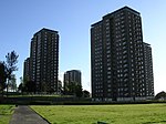
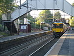
Garscadden (Gaelic: Gart Sgadan) is a district in the Scottish city of Glasgow. It is situated north of the River Clyde. It lies between Yoker to the west, Scotstoun to the east and Knightswood to the north. It has a train station close to Knightswood shopping centre and Yoker Railway Depot. Garscadden railway station is on the Argyle Line.
Excerpt from the Wikipedia article Garscadden (License: CC BY-SA 3.0, Authors, Images).Garscadden
Craggan Drive, Glasgow Blawarthill
Geographical coordinates (GPS) Address Nearby Places Show on map
Geographical coordinates (GPS)
| Latitude | Longitude |
|---|---|
| N 55.886861 ° | E -4.366265 ° |
Address
Craggan Drive
Craggan Drive
Glasgow, Blawarthill
Scotland, United Kingdom
Open on Google Maps


