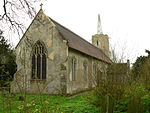
Kirby Cane

Kirby Cane is a scattered village and civil parish centred 3.8 miles (6.1 km) west northwest of Beccles and 2.7 miles (4.3 km) northeast of Bungay. It is in south-east Norfolk. It housed 375 people in 152 households as at 2001 – then 434 in 179 households at the 2011 Census, the increase in households being almost 18% – unusually large for England. Its north-eastern neighbourhood is often known as Kirby Green. The most populous part is often known as Kirby Row, which is 0.3 miles (0.48 km) from the heart of Ellingham, Norfolk and which is, narrowly, mainly in that parish – whether taken in its historical borders or on its similar boundaries of today. The land drains gently south to the Waveney which is the border with Suffolk. Further north of its isolated church and its small smattering of houses is Wash Lane which leads to the A146 road (between Norwich and Beccles). The church is 12.4 miles (20.0 km) from Norwich in the centre of the county.
Excerpt from the Wikipedia article Kirby Cane (License: CC BY-SA 3.0, Authors, Images).Kirby Cane
Loddon Road, South Norfolk
Geographical coordinates (GPS) Address Nearby Places Show on map
Geographical coordinates (GPS)
| Latitude | Longitude |
|---|---|
| N 52.493 ° | E 1.495 ° |
Address
Loddon Road
NR35 2HN South Norfolk
England, United Kingdom
Open on Google Maps


