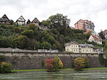
Laufenburg District
Districts of AargauPages with non-numeric formatnum argumentsSwiss populations data templates/Failure
Laufenburg District is a district of the canton of Aargau, Switzerland, essentially consisting of the upper Fricktal valley in the Aargau Jura south of the Rhine. Its capital is the town of Laufenburg. It has a population of 33,279 (as of 31 December 2020).
Excerpt from the Wikipedia article Laufenburg District (License: CC BY-SA 3.0, Authors).Laufenburg District
Unterhalden,
Geographical coordinates (GPS) Address Nearby Places Show on map
Geographical coordinates (GPS)
| Latitude | Longitude |
|---|---|
| N 47.55 ° | E 8.05 ° |
Address
Unterhalden
Unterhalden
5082
Aargau, Switzerland
Open on Google Maps


