'En Esur

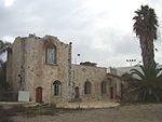
'En Esur, also En Esur (Hebrew: עין אֵסוּר; [ʕen ʔesuʁ] eh-N eh-s-oor) or Ein Asawir (Arabic: عين الأساور, lit. 'Spring of the Bracelets'), is an ancient site located on the northern Sharon Plain, at the entrance of the Wadi Ara pass leading from the Coastal Plain further inland. The site includes an archaeological mound (tell), called Tel Esur or Tell el-Asawir, another unnamed mound, and two springs, one of which gives the site its name. A 7,000-year-old Early Chalcolithic large village already showing signs of incipient urbanisation and with an open space used for cultic activities was discovered at the site below later, Bronze Age remains.During the Early Bronze Age, around 3000 BCE, a massive fortified proto-city with an estimated population of 5,000 to 6,000 inhabitants existed there. It was the largest city in the region, larger than other significant sites such as Megiddo and Jericho, but smaller than more distant ones in Egypt and Mesopotamia. The city was discovered in 1977, but its massive extent was realized only in 1993. A major excavation between 2017 and 2019 ahead of the construction of a highway interchange exposed the city's houses, streets and public structures, as well as countless artifacts including pottery, figurines and tools. Archaeologists announced its discovery in 2019, calling it the "New York of the Early Bronze Age".
Excerpt from the Wikipedia article 'En Esur (License: CC BY-SA 3.0, Authors, Images).'En Esur
Wadi Ara, Menashe Regional Council
Geographical coordinates (GPS) Address External links Nearby Places Show on map
Geographical coordinates (GPS)
| Latitude | Longitude |
|---|---|
| N 32.481944444444 ° | E 35.019444444444 ° |
Address
תל אסור
Wadi Ara
Menashe Regional Council
Haifa District, Israel
Open on Google Maps


