place

Haleys Branch (Crabtree Creek tributary)

Rivers of North CarolinaRivers of Wake County, North CarolinaTributaries of Pamlico Sound
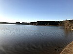
Photo of Haleys Branch

Haleys Branch is a tributary to Crabtree Creek that rises just south of the Raleigh-Durham (RDU) airport then flows south to meet Crabtree Creek in Lake Crabtree. The watershed is about 68% forested.

Excerpt from the Wikipedia article Haleys Branch (Crabtree Creek tributary) (License: CC BY-SA 3.0, Authors, Images).

Haleys Branch (Crabtree Creek tributary)
Black Creek Greenway, Cary

Geographical coordinates (GPS) Address Nearby Places
placeShow on map

Wikipedia: Haleys Branch (Crabtree Creek tributary)Continue reading on Wikipedia

Geographical coordinates (GPS)

Latitude Longitude
N 35.838333333333 ° E -78.784444444444 °
placeShow on map

Address

Black Creek Greenway
27513 Cary
North Carolina, United States
mapOpen on Google Maps

Photo of Haleys Branch
Share experience

Nearby Places

Lake Crabtree County Park

Lake Crabtree County Park is a park in Wake County, North Carolina. It is a forested area between Cary, Morrisville, and Raleigh-Durham International Airport, bounded by the northeastern shore of Lake Crabtree, I-40, and Aviation Parkway. The main entrance is on the Aviation Parkway side and is equipped with two playgrounds (for different age groups), a boat dock (as well as rentable sailboats), bathrooms, an observation tower, and other amenities. A system of hiking and biking trails crosses through the park, with the most used one (especially by hikers) along the lakeshore. This trail connects the park entrance to the Black Creek Greenway-Old Reedy Creek Road intersection, near the entrance to William B. Umstead State Park. Since 2012, Lake Crabtree County Park has been a host venue for the Valor Games Southeast, a three-day adapted-sports competition for veterans and members of the Armed Forces with disabilities. The park features a wheelchair accessible dock providing unparalleled access to the water for people with disabilities. Since 2016, Lake Crabtree is home to the NC State University Sailing Team, and the host venue for the SailPack Women's Intercollegiate Regatta, as well as the Triangle Tango Regatta, a co-ed fleet racing event, both held in the fall. Community Sailing is a featured activity during the summer at the Lake. The RTP High School sailing program is also located at Lake Crabtree and hosts interscholastic regattas on site.

Raleigh, North Carolina

Raleigh (; RAH-lee) is the capital city of the U.S. state of North Carolina and the seat of Wake County. It is the second-most populous city in North Carolina, after Charlotte. Raleigh is the tenth-most populous city in the Southeast, the 41st-most populous city in the U.S., and the largest city of the Research Triangle metro area. Raleigh is known as the "City of Oaks" for its many oak trees, which line the streets in the heart of the city. The city covers a land area of 147.6 sq mi (382 km2). The U.S. Census Bureau counted the city's population as 467,665 in the 2020 census. It is one of the fastest-growing cities in the United States. The city of Raleigh is named after Sir Walter Raleigh, who established the now-lost Roanoke Colony in present-day Dare County. Raleigh is home to North Carolina State University (NC State or NCSU) and is part of the Research Triangle together with Durham (home of Duke University and North Carolina Central University) and Chapel Hill (home of the University of North Carolina at Chapel Hill). The name of the Research Triangle (often shortened to "The Triangle") originated after the 1959 creation of Research Triangle Park (RTP), located in Durham and Wake counties, among the three cities and universities. The Triangle encompasses the Raleigh-Durham-Cary, NC Combined Statistical Area, which had a population of 2,106,463 in 2020. The Raleigh, NC Metropolitan Statistical Area had an estimated population of 1,413,982 in 2020.Most of Raleigh is located within Wake County, with a small portion extending into Durham County. The towns of Apex, Cary, Clayton, Fuquay-Varina, Garner, Holly Springs, Knightdale, Morrisville, Rolesville, Wake Forest, Wendell, and Zebulon are some of Raleigh's primary nearby suburbs and satellite towns. Raleigh is an early example in the United States of a planned city. Following the American Revolutionary War when the U.S. gained independence, the area was chosen as the site of the state capital in 1788 and incorporated in 1792 as such. The city was originally laid out in a grid pattern with the North Carolina State Capitol at the center, in Union Square. During the American Civil War, the city was spared from any significant battle. It fell to the Union in the closing days of the war and struggled with the economic hardships in the postwar period, related to the reconstitution of labor markets, over-reliance on agriculture and the social unrest of the Reconstruction Era. The establishment of the Research Triangle Park (RTP) in 1959 helped create tens of thousands of jobs in the fields of science and technology. By the early 21st century, Raleigh had become one of the fastest-growing cities in the United States.

Research Triangle
Research Triangle

The Research Triangle, or simply The Triangle, are both common nicknames for a metropolitan area in the Piedmont region of the U.S. state of North Carolina. Anchored by the cities of Raleigh and Durham and the town of Chapel Hill, the region is home to three major research universities: North Carolina State University, Duke University, and the University of North Carolina at Chapel Hill, respectively. The "Triangle" name originated in the 1950s with the creation of Research Triangle Park located between the three anchor cities, which is the largest research park in the United States and home to numerous high tech companies.The nine-county region, officially named the Raleigh-Durham-Cary, NC Combined Statistical Area by the Office of Management and Budget, comprises the Raleigh-Cary, Durham-Chapel Hill, and Henderson, NC Metropolitan Statistical Areas. The 2020 census put the population of the area at 2,106,463, making it the second-largest combined statistical area in North Carolina, behind Charlotte. The Raleigh–Durham television market includes a broader 24-county area which includes Fayetteville, North Carolina, and has a population of 2,726,000 persons. Most of the Triangle is part of North Carolina's first, second, fourth, ninth, and thirteenth congressional districts.The region is sometimes confused with the Piedmont Triad, which is a North Carolina region adjacent to and directly west of the Triangle comprising Greensboro, Winston-Salem, and High Point, among other cities.