place

Cedar Fork Township, Wake County, North Carolina

Townships in North CarolinaTownships in Wake County, North CarolinaUse mdy dates from July 2023Wake County, North Carolina geography stubs
WakeCountyNC CedarForkTownship

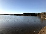
Cedar Fork Township (also designated Township 5) is one of twenty townships within Wake County, North Carolina, United States. As of the 2010 census, Cedar Fork Township had a population of 40,841, a 274.3% increase over 2000.Cedar Fork Township, occupying 36.5 square miles (94.6 km2) in northwestern Wake County, includes all of the town of Morrisville, portions of Cary, Raleigh, and the Research Triangle Park, as well as the Raleigh-Durham International Airport. The southeastern portion of Triangle Township in Durham County that borders Wake County was originally a separate Durham township also named Cedar Fork.

Excerpt from the Wikipedia article Cedar Fork Township, Wake County, North Carolina (License: CC BY-SA 3.0, Authors, Images).

Cedar Fork Township, Wake County, North Carolina
I 40,

Geographical coordinates (GPS) Address Nearby Places
placeShow on map

Wikipedia: Cedar Fork Township, Wake County, North CarolinaContinue reading on Wikipedia

Geographical coordinates (GPS)

Latitude Longitude
N 35.861111111111 ° E -78.814722222222 °
placeShow on map

Address

I 40
27650
North Carolina, United States
mapOpen on Google Maps

WakeCountyNC CedarForkTownship
Share experience

Nearby Places

Lake Crabtree County Park

Lake Crabtree County Park is a park in Wake County, North Carolina. It is a forested area between Cary, Morrisville, and Raleigh-Durham International Airport, bounded by the northeastern shore of Lake Crabtree, I-40, and Aviation Parkway. The main entrance is on the Aviation Parkway side and is equipped with two playgrounds (for different age groups), a boat dock (as well as rentable sailboats), bathrooms, an observation tower, and other amenities. A system of hiking and biking trails crosses through the park, with the most used one (especially by hikers) along the lakeshore. This trail connects the park entrance to the Black Creek Greenway-Old Reedy Creek Road intersection, near the entrance to William B. Umstead State Park. Since 2012, Lake Crabtree County Park has been a host venue for the Valor Games Southeast, a three-day adapted-sports competition for veterans and members of the Armed Forces with disabilities. The park features a wheelchair accessible dock providing unparalleled access to the water for people with disabilities. Since 2016, Lake Crabtree is home to the NC State University Sailing Team, and the host venue for the SailPack Women's Intercollegiate Regatta, as well as the Triangle Tango Regatta, a co-ed fleet racing event, both held in the fall. Community Sailing is a featured activity during the summer at the Lake. The RTP High School sailing program is also located at Lake Crabtree and hosts interscholastic regattas on site.

Research Triangle
Research Triangle

The Research Triangle, or simply The Triangle, are both common nicknames for a metropolitan area in the Piedmont region of the U.S. state of North Carolina. Anchored by the cities of Raleigh and Durham and the town of Chapel Hill, the region is home to three major research universities: North Carolina State University, Duke University, and the University of North Carolina at Chapel Hill, respectively. The "Triangle" name originated in the 1950s with the creation of Research Triangle Park located between the three anchor cities, which is the largest research park in the United States and home to numerous high tech companies.The nine-county region, officially named the Raleigh-Durham-Cary, NC Combined Statistical Area by the Office of Management and Budget, comprises the Raleigh-Cary, Durham-Chapel Hill, and Henderson, NC Metropolitan Statistical Areas. The 2020 census put the population of the area at 2,106,463, making it the second-largest combined statistical area in North Carolina, behind Charlotte. The Raleigh–Durham television market includes a broader 24-county area which includes Fayetteville, North Carolina, and has a population of 2,726,000 persons. Most of the Triangle is part of North Carolina's first, second, fourth, ninth, and thirteenth congressional districts.The region is sometimes confused with the Piedmont Triad, which is a North Carolina region adjacent to and directly west of the Triangle comprising Greensboro, Winston-Salem, and High Point, among other cities.

Battle of Morrisville

The Battle of Morrisville, also known as the Battle at Morrisville Station, was fought April 13–15, 1865, in Morrisville, North Carolina during the Carolinas Campaign of the American Civil War. It was the last official battle of the Civil War between the armies of Major General William T. Sherman and General Joseph E. Johnston. General Judson Kilpatrick, commanding officer of the Union cavalry advance, forced Confederate forces, under the command of Generals Wade Hampton III and Joseph Wheeler, to withdraw in haste. The Confederates were frantically trying to transport their remaining supplies and wounded westward, by rail, toward the final Confederate encampment in Greensboro, NC, which, unbeknownst to them, had fallen under attack by the 3rd North Carolina Mounted Infantry as part of Stoneman's Raid. Kilpatrick used artillery on the heights overlooking Morrisville Station and cavalry charges to push the Confederates out of the small village leaving many needed supplies behind. However, the trains were able to withdraw with wounded soldiers from the Battle of Bentonville and the Battle of Averasborough. Later, General Johnston sent a courier to the Federal encampments at Morrisville with a message for Major General Sherman requesting a conference to discuss an armistice. Several days later the two generals met at Bennett Place on April 17, 1865 to begin discussing the terms of what would become the largest surrender of the war.Due to the development of the area, hardly any evidence of the battle remains. Some heavily trampled breastwork is still visible in the woods by the train tracks. The North Carolina government has installed a sign marking the approximate location of the battle.