place

Pío Pico State Historic Park

Adobe buildings and structures in CaliforniaBuildings and structures on the National Register of Historic Places in Los Angeles County, CaliforniaCalifornia Historical LandmarksCalifornia State Historic ParksHistoric house museums in California
History of Los AngelesHistory of Los Angeles County, CaliforniaHouses in Los Angeles County, CaliforniaHouses on the National Register of Historic Places in CaliforniaMexican CaliforniaMuseums in Los Angeles County, CaliforniaParks in Los Angeles County, CaliforniaProtected areas established in 1927San Gabriel ValleyWhittier, California
Pio Pico State Historic Park 2007

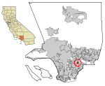
Pío Pico State Historic Park is the site of El Ranchito, also known as the Pío Pico Adobe or Pío Pico Mansion, the final home of Pío Pico, the last Governor of Alta California under Mexican rule and a pivotal figure in early California history. Located in Whittier, California, at 6003 Pioneer Blvd. near Whittier Blvd. and Interstate 605, it is California Historical Landmark No. 127, listed as "Casa de Governor Pío Pico". Just west of the park is the San Gabriel River. Across the river is the city that bears his name—Pico Rivera. The park consists of the adobe and about three acres of surrounding land.

Excerpt from the Wikipedia article Pío Pico State Historic Park (License: CC BY-SA 3.0, Authors, Images).

Pío Pico State Historic Park
Pioneer Boulevard,

Geographical coordinates (GPS) Address Nearby Places
placeShow on map

Wikipedia: Pío Pico State Historic ParkContinue reading on Wikipedia

Geographical coordinates (GPS)

Latitude Longitude
N 33.993636 ° E -118.071075 °
placeShow on map

Address

Pico Adobe

Pioneer Boulevard 6003
90606
California, United States
mapOpen on Google Maps

Pio Pico State Historic Park 2007
Share experience

Nearby Places

Golden West Airlines Flight 261

Golden West Airlines Flight 261, a De Havilland Twin Otter DHC-6, collided with a Cessna 150 (N11421), owned by CessnAir Aviation, Inc., near Whittier, California. The accident occurred on January 9, 1975, at approximately 4:07 p.m. PST, while the Sun was just 9 degrees above the western horizon, directly into the eyes of the pilots of GW flight 261. Both aircraft were destroyed by the collision and subsequent ground impact. The 10 passengers and 2 pilots on the Twin Otter, and the instructor pilot and student pilot in the Cessna 150 were killed. Debris fell on homes and lawns but no one on the ground was injured. The wreckage of both aircraft was scattered over an 8 to 10 city block area. The fuselage of the Twin Otter fell into the schoolyard of Katherine Edwards Middle School, where about 300 spectators were watching an outdoor basketball game, while the wings landed two blocks away. The fuselage of the Cessna fell in the front yard of a house, about two blocks from the Otter fuselage. The Cessna impacted the left side of the Twin Otter at an approximate angle of 90 degrees. "(1) the Cessna's firewall and instrument panel were embedded in the Twin Otter's fuselage forward of the wing; (2) the propeller slashes in the Cessna's right wing formed an angle of about 88 degrees with the wing leading edge; and (3) the Twin Otter's left engine nacelle and engine were driven inboard by the collision." Ground witnesses said that neither plane made any last moment maneuver attempt to avoid the collision. GW 261 was a regularly scheduled passenger flight between the Ontario International Airport (ONT) and the Los Angeles International Airport (LAX), both in the Los Angeles area of California. The flight departed from ONT at 1556 PST, on a visual flight rules (VFR) flight plan. That separated GW 261 from the larger aircraft, which arrived at LAX on instrument flight rules (IFR) flight plans. The IFR flights were required to remain within the confines of the Los Angeles Group 1 terminal control area (TCA), while smaller planes were required to remain outside of the TCA, until the designated entry point, which was specified in their assigned VFR TCA arrival. In the case of GW 261, it was to remain outside of the TCA until the 10 DME fix of runway 24 right localizer, and to enter at an altitude of 1,500 feet MSL. The top of the TCA was 7,000 feet, while the base varied, depending on the distance from LAX. That mixed it in with all the other small plane VFR traffic in the Los Angeles Basin, which did not have transponders. Most of those were not flying to LAX, so they were not in radio communication with LAX radar controllers. The only defense was the "see and be seen" method of collision avoidance. That deficient method of traffic separation failed to work that day, as it has failed many other times in high density traffic areas.

Whittier Narrows Dam

Whittier Narrows Dam is a 56-foot (17 m) tall earth dam on the San Gabriel River and the smaller, parallel Rio Hondo. The dam is located, as the name implies, at the Whittier Narrows. It provides water conservation storage and is also the central element of the Los Angeles County Drainage Area (LACDA) flood control system. Its reservoir has a capacity of 67,060 acre⋅ft (82,720,000 m3). The Whittier Narrows are a natural gap in the hills that form the southern boundary of the San Gabriel Valley of Southern California. Both the Rio Hondo, a tributary of the Los Angeles River, and the San Gabriel River flow through this gap and are impounded by the reservoir. The Pomona Freeway (CA-60) passes through the reservoir flood control basin and the San Gabriel River Freeway (I-605) passes along the eastern boundary of the basin. In September 2017, the United States Army Corps of Engineers officials warned local residents that the dam no longer met the agency’s 'tolerable-risk' guidelines and could fail in the event of a very large, very rare storm, similar to exceptionally intense California storms which occurred between December 1861 and January 1862, a so-called ARkStormAuthorization for the project construction is contained in the Flood Control Act of 18 August 1941 (PL 77-228) and the initial funds for construction were provided in the 1949 Appropriations Bill. The U.S. Army Corps of Engineers completed construction of the dam in 1957.