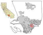
Golden West Airlines Flight 261, a De Havilland Twin Otter DHC-6, collided with a Cessna 150 (N11421), owned by CessnAir Aviation, Inc., near Whittier, California. The accident occurred on January 9, 1975, at approximately 4:07 p.m. PST, while the Sun was just 9 degrees above the western horizon, directly into the eyes of the pilots of GW flight 261.
Both aircraft were destroyed by the collision and subsequent ground impact. The 10 passengers and 2 pilots on the Twin Otter, and the instructor pilot and student pilot in the Cessna 150 were killed. Debris fell on homes and lawns but no one on the ground was injured. The wreckage of both aircraft was scattered over an 8 to 10 city block area. The fuselage of the Twin Otter fell into the schoolyard of Katherine Edwards Middle School, where about 300 spectators were watching an outdoor basketball game, while the wings landed two blocks away. The fuselage of the Cessna fell in the front yard of a house, about two blocks from the Otter fuselage.
The Cessna impacted the left side of the Twin Otter at an approximate angle of 90 degrees. "(1) the Cessna's firewall and instrument panel were embedded in the Twin Otter's fuselage forward of the wing; (2) the propeller slashes in the Cessna's right wing formed an angle of about 88 degrees with the wing leading edge; and (3) the Twin Otter's left engine nacelle and engine were driven inboard by the collision." Ground witnesses said that neither plane made any last moment maneuver attempt to avoid the collision.
GW 261 was a regularly scheduled passenger flight between the Ontario International Airport (ONT) and the Los Angeles International Airport (LAX), both in the Los Angeles area of California. The flight departed from ONT at 1556 PST, on a visual flight rules (VFR) flight plan. That separated GW 261 from the larger aircraft, which arrived at LAX on instrument flight rules (IFR) flight plans.
The IFR flights were required to remain within the confines of the Los Angeles Group 1 terminal control area (TCA), while smaller planes were required to remain outside of the TCA, until the designated entry point, which was specified in their assigned VFR TCA arrival. In the case of GW 261, it was to remain outside of the TCA until the 10 DME fix of runway 24 right localizer, and to enter at an altitude of 1,500 feet MSL. The top of the TCA was 7,000 feet, while the base varied, depending on the distance from LAX. That mixed it in with all the other small plane VFR traffic in the Los Angeles Basin, which did not have transponders. Most of those were not flying to LAX, so they were not in radio communication with LAX radar controllers. The only defense was the "see and be seen" method of collision avoidance. That deficient method of traffic separation failed to work that day, as it has failed many other times in high density traffic areas.


